You are here: Home > Network List > G - GEOSCOPE Stations List
> Station RER Riviere de l'Est, La Reunion (Indian Ocean) > Earthquake Result Viewer
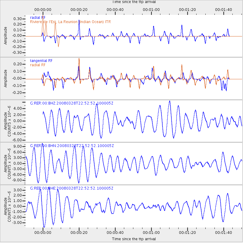
RER Riviere de l'Est, La Reunion (Indian Ocean) - Earthquake Result Viewer
*The percent match for this event was below the threshold and hence no stack was calculated.
| Earthquake location: |
Philippine Islands Region |
| Earthquake latitude/longitude: |
20.3/121.9 |
| Earthquake time(UTC): |
2008/03/28 (088) 22:41:32 GMT |
| Earthquake Depth: |
10 km |
| Earthquake Magnitude: |
5.6 MB, 5.6 MS, 5.8 MW, 5.8 MW |
| Earthquake Catalog/Contributor: |
WHDF/NEIC |
|
| Network: |
G GEOSCOPE |
| Station: |
RER Riviere de l'Est, La Reunion (Indian Ocean) |
| Lat/Lon: |
21.16 S/55.75 E |
| Elevation: |
834 m |
|
| Distance: |
76.7 deg |
| Az: |
241.354 deg |
| Baz: |
61.983 deg |
| Ray Param: |
$rayparam |
*The percent match for this event was below the threshold and hence was not used in the summary stack. |
|
| Radial Match: |
69.76186 % |
| Radial Bump: |
345 |
| Transverse Match: |
48.695354 % |
| Transverse Bump: |
400 |
| SOD ConfigId: |
2504 |
| Insert Time: |
2010-02-26 23:46:42.834 +0000 |
| GWidth: |
2.5 |
| Max Bumps: |
400 |
| Tol: |
0.001 |
|
Signal To Noise
| Channel | StoN | STA | LTA |
| G:RER:00:BHN:20080328T22:52:52.100005Z | 2.7103329 | 7.214294E-6 | 2.661774E-6 |
| G:RER:00:BHE:20080328T22:52:52.100005Z | 1.7625126 | 2.519306E-6 | 1.4293834E-6 |
| G:RER:00:BHZ:20080328T22:52:52.100005Z | 1.5735823 | 3.6806055E-6 | 2.3389978E-6 |
| Arrivals |
| Ps | |
| PpPs | |
| PsPs/PpSs | |


