You are here: Home > Network List > G - GEOSCOPE Stations List
> Station RER Riviere de l'Est, La Reunion (Indian Ocean) > Earthquake Result Viewer
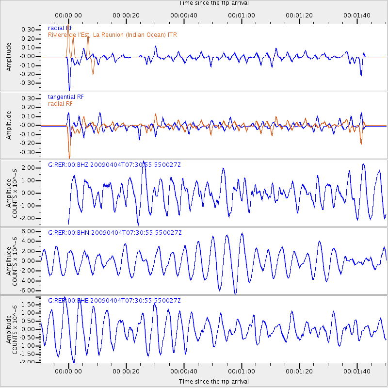
RER Riviere de l'Est, La Reunion (Indian Ocean) - Earthquake Result Viewer
*The percent match for this event was below the threshold and hence no stack was calculated.
| Earthquake location: |
Balleny Islands Region |
| Earthquake latitude/longitude: |
-62.6/155.1 |
| Earthquake time(UTC): |
2009/04/04 (094) 07:19:41 GMT |
| Earthquake Depth: |
10 km |
| Earthquake Magnitude: |
5.7 MS, 5.3 MB, 5.9 MW, 5.9 MW |
| Earthquake Catalog/Contributor: |
WHDF/NEIC |
|
| Network: |
G GEOSCOPE |
| Station: |
RER Riviere de l'Est, La Reunion (Indian Ocean) |
| Lat/Lon: |
21.16 S/55.75 E |
| Elevation: |
834 m |
|
| Distance: |
75.7 deg |
| Az: |
251.914 deg |
| Baz: |
151.889 deg |
| Ray Param: |
$rayparam |
*The percent match for this event was below the threshold and hence was not used in the summary stack. |
|
| Radial Match: |
48.68888 % |
| Radial Bump: |
400 |
| Transverse Match: |
59.37974 % |
| Transverse Bump: |
400 |
| SOD ConfigId: |
2658 |
| Insert Time: |
2010-02-26 23:46:58.152 +0000 |
| GWidth: |
2.5 |
| Max Bumps: |
400 |
| Tol: |
0.001 |
|
Signal To Noise
| Channel | StoN | STA | LTA |
| G:RER:00:BHN:20090404T07:30:55.550027Z | 0.79329056 | 1.6388732E-6 | 2.065918E-6 |
| G:RER:00:BHE:20090404T07:30:55.550027Z | 2.3739588 | 1.3797516E-6 | 5.812028E-7 |
| G:RER:00:BHZ:20090404T07:30:55.550027Z | 0.95131016 | 8.6725436E-7 | 9.11642E-7 |
| Arrivals |
| Ps | |
| PpPs | |
| PsPs/PpSs | |


