You are here: Home > Network List > TA - USArray Transportable Network (new EarthScope stations) Stations List
> Station L39A Vinton, IA, USA > Earthquake Result Viewer
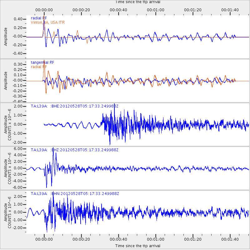
L39A Vinton, IA, USA - Earthquake Result Viewer
*The percent match for this event was below the threshold and hence no stack was calculated.
| Earthquake location: |
Santiago Del Estero Prov., Arg. |
| Earthquake latitude/longitude: |
-28.0/-63.1 |
| Earthquake time(UTC): |
2012/05/28 (149) 05:07:23 GMT |
| Earthquake Depth: |
587 km |
| Earthquake Magnitude: |
6.0 MB, 6.7 MW, 6.8 MW |
| Earthquake Catalog/Contributor: |
WHDF/NEIC |
|
| Network: |
TA USArray Transportable Network (new EarthScope stations) |
| Station: |
L39A Vinton, IA, USA |
| Lat/Lon: |
42.12 N/92.00 W |
| Elevation: |
261 m |
|
| Distance: |
74.7 deg |
| Az: |
338.115 deg |
| Baz: |
153.713 deg |
| Ray Param: |
$rayparam |
*The percent match for this event was below the threshold and hence was not used in the summary stack. |
|
| Radial Match: |
72.539345 % |
| Radial Bump: |
400 |
| Transverse Match: |
68.4205 % |
| Transverse Bump: |
400 |
| SOD ConfigId: |
455246 |
| Insert Time: |
2012-09-25 00:11:51.867 +0000 |
| GWidth: |
2.5 |
| Max Bumps: |
400 |
| Tol: |
0.001 |
|
Signal To Noise
| Channel | StoN | STA | LTA |
| TA:L39A: :BHZ:20120528T05:17:33.249988Z | 8.121069 | 2.3506873E-6 | 2.894554E-7 |
| TA:L39A: :BHN:20120528T05:17:33.249988Z | 3.6904304 | 9.714371E-7 | 2.6323139E-7 |
| TA:L39A: :BHE:20120528T05:17:33.249988Z | 2.8077538 | 4.7599528E-7 | 1.6952885E-7 |
| Arrivals |
| Ps | |
| PpPs | |
| PsPs/PpSs | |


