You are here: Home > Network List > TA - USArray Transportable Network (new EarthScope stations) Stations List
> Station T46A Princeton, KY, USA > Earthquake Result Viewer
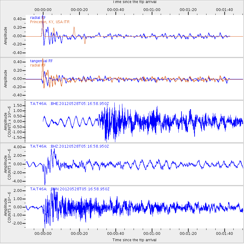
T46A Princeton, KY, USA - Earthquake Result Viewer
*The percent match for this event was below the threshold and hence no stack was calculated.
| Earthquake location: |
Santiago Del Estero Prov., Arg. |
| Earthquake latitude/longitude: |
-28.0/-63.1 |
| Earthquake time(UTC): |
2012/05/28 (149) 05:07:23 GMT |
| Earthquake Depth: |
587 km |
| Earthquake Magnitude: |
6.0 MB, 6.7 MW, 6.8 MW |
| Earthquake Catalog/Contributor: |
WHDF/NEIC |
|
| Network: |
TA USArray Transportable Network (new EarthScope stations) |
| Station: |
T46A Princeton, KY, USA |
| Lat/Lon: |
37.04 N/87.89 W |
| Elevation: |
169 m |
|
| Distance: |
68.8 deg |
| Az: |
338.902 deg |
| Baz: |
156.569 deg |
| Ray Param: |
$rayparam |
*The percent match for this event was below the threshold and hence was not used in the summary stack. |
|
| Radial Match: |
77.48618 % |
| Radial Bump: |
400 |
| Transverse Match: |
68.77416 % |
| Transverse Bump: |
400 |
| SOD ConfigId: |
455246 |
| Insert Time: |
2012-09-25 00:19:15.671 +0000 |
| GWidth: |
2.5 |
| Max Bumps: |
400 |
| Tol: |
0.001 |
|
Signal To Noise
| Channel | StoN | STA | LTA |
| TA:T46A: :BHZ:20120528T05:16:58.950Z | 3.9978256 | 1.8596414E-6 | 4.651632E-7 |
| TA:T46A: :BHN:20120528T05:16:58.950Z | 5.8107767 | 9.902806E-7 | 1.7042137E-7 |
| TA:T46A: :BHE:20120528T05:16:58.950Z | 1.9645525 | 5.2808275E-7 | 2.6880562E-7 |
| Arrivals |
| Ps | |
| PpPs | |
| PsPs/PpSs | |


