You are here: Home > Network List > TA - USArray Transportable Network (new EarthScope stations) Stations List
> Station Z51A Franklin, GA, USA > Earthquake Result Viewer
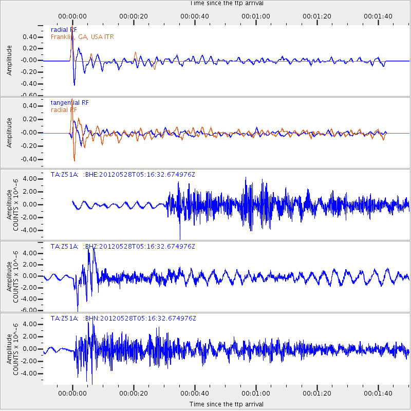
Z51A Franklin, GA, USA - Earthquake Result Viewer
*The percent match for this event was below the threshold and hence no stack was calculated.
| Earthquake location: |
Santiago Del Estero Prov., Arg. |
| Earthquake latitude/longitude: |
-28.0/-63.1 |
| Earthquake time(UTC): |
2012/05/28 (149) 05:07:23 GMT |
| Earthquake Depth: |
587 km |
| Earthquake Magnitude: |
6.0 MB, 6.7 MW, 6.8 MW |
| Earthquake Catalog/Contributor: |
WHDF/NEIC |
|
| Network: |
TA USArray Transportable Network (new EarthScope stations) |
| Station: |
Z51A Franklin, GA, USA |
| Lat/Lon: |
33.32 N/85.17 W |
| Elevation: |
249 m |
|
| Distance: |
64.5 deg |
| Az: |
339.594 deg |
| Baz: |
158.404 deg |
| Ray Param: |
$rayparam |
*The percent match for this event was below the threshold and hence was not used in the summary stack. |
|
| Radial Match: |
75.50548 % |
| Radial Bump: |
400 |
| Transverse Match: |
73.58848 % |
| Transverse Bump: |
400 |
| SOD ConfigId: |
455246 |
| Insert Time: |
2012-09-25 00:23:06.320 +0000 |
| GWidth: |
2.5 |
| Max Bumps: |
400 |
| Tol: |
0.001 |
|
Signal To Noise
| Channel | StoN | STA | LTA |
| TA:Z51A: :BHZ:20120528T05:16:32.674976Z | 3.639771 | 1.8240047E-6 | 5.0113175E-7 |
| TA:Z51A: :BHN:20120528T05:16:32.674976Z | 4.9458055 | 1.5515756E-6 | 3.1371545E-7 |
| TA:Z51A: :BHE:20120528T05:16:32.674976Z | 3.0748558 | 9.353043E-7 | 3.0417826E-7 |
| Arrivals |
| Ps | |
| PpPs | |
| PsPs/PpSs | |


