You are here: Home > Network List > UW - Pacific Northwest Regional Seismic Network Stations List
> Station MRBL Marblemount, WA, USA > Earthquake Result Viewer
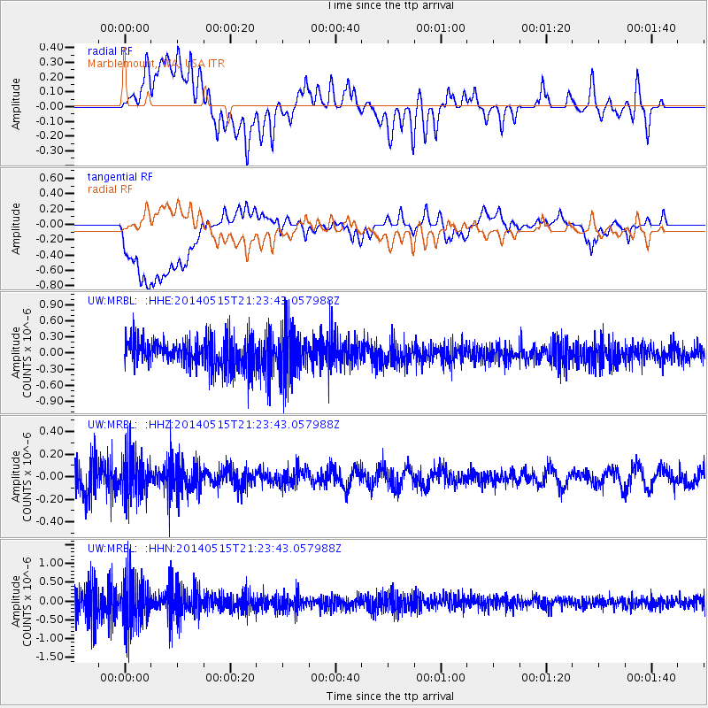
MRBL Marblemount, WA, USA - Earthquake Result Viewer
*The percent match for this event was below the threshold and hence no stack was calculated.
| Earthquake location: |
Philippine Islands Region |
| Earthquake latitude/longitude: |
19.5/121.3 |
| Earthquake time(UTC): |
2014/05/15 (135) 21:11:04 GMT |
| Earthquake Depth: |
10 km |
| Earthquake Magnitude: |
4.6 mb |
| Earthquake Catalog/Contributor: |
ISC/ISC |
|
| Network: |
UW Pacific Northwest Regional Seismic Network |
| Station: |
MRBL Marblemount, WA, USA |
| Lat/Lon: |
48.52 N/121.48 W |
| Elevation: |
75 m |
|
| Distance: |
92.2 deg |
| Az: |
36.285 deg |
| Baz: |
302.91 deg |
| Ray Param: |
$rayparam |
*The percent match for this event was below the threshold and hence was not used in the summary stack. |
|
| Radial Match: |
49.73122 % |
| Radial Bump: |
400 |
| Transverse Match: |
49.821754 % |
| Transverse Bump: |
400 |
| SOD ConfigId: |
3390531 |
| Insert Time: |
2019-04-11 21:43:52.544 +0000 |
| GWidth: |
2.5 |
| Max Bumps: |
400 |
| Tol: |
0.001 |
|
Signal To Noise
| Channel | StoN | STA | LTA |
| UW:MRBL: :HHZ:20140515T21:23:43.057988Z | 1.5812187 | 1.8885369E-7 | 1.1943553E-7 |
| UW:MRBL: :HHN:20140515T21:23:43.057988Z | 2.146381 | 6.5928134E-7 | 3.0715952E-7 |
| UW:MRBL: :HHE:20140515T21:23:43.057988Z | 1.7136097 | 4.5720577E-7 | 2.668086E-7 |
| Arrivals |
| Ps | |
| PpPs | |
| PsPs/PpSs | |


