You are here: Home > Network List > GS - US Geological Survey Networks Stations List
> Station DEC12 Boyd Road Surface Site > Earthquake Result Viewer
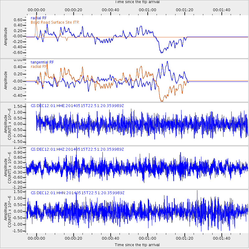
DEC12 Boyd Road Surface Site - Earthquake Result Viewer
*The percent match for this event was below the threshold and hence no stack was calculated.
| Earthquake location: |
Near Coast Of Northern Peru |
| Earthquake latitude/longitude: |
-7.7/-79.5 |
| Earthquake time(UTC): |
2014/05/15 (135) 22:43:17 GMT |
| Earthquake Depth: |
62 km |
| Earthquake Magnitude: |
5.0 MW |
| Earthquake Catalog/Contributor: |
ISC/ISC |
|
| Network: |
GS US Geological Survey Networks |
| Station: |
DEC12 Boyd Road Surface Site |
| Lat/Lon: |
39.91 N/88.91 W |
| Elevation: |
208 m |
|
| Distance: |
48.1 deg |
| Az: |
350.242 deg |
| Baz: |
167.385 deg |
| Ray Param: |
$rayparam |
*The percent match for this event was below the threshold and hence was not used in the summary stack. |
|
| Radial Match: |
42.830837 % |
| Radial Bump: |
400 |
| Transverse Match: |
44.445553 % |
| Transverse Bump: |
400 |
| SOD ConfigId: |
3390531 |
| Insert Time: |
2019-04-11 21:47:20.394 +0000 |
| GWidth: |
2.5 |
| Max Bumps: |
400 |
| Tol: |
0.001 |
|
Signal To Noise
| Channel | StoN | STA | LTA |
| GS:DEC12:01:HHZ:20140515T22:51:20.359989Z | 1.3073927 | 2.4173298E-7 | 1.8489699E-7 |
| GS:DEC12:01:HHN:20140515T22:51:20.359989Z | 1.1646482 | 3.834489E-7 | 3.292401E-7 |
| GS:DEC12:01:HHE:20140515T22:51:20.359989Z | 0.9231152 | 3.90525E-7 | 4.230512E-7 |
| Arrivals |
| Ps | |
| PpPs | |
| PsPs/PpSs | |


