You are here: Home > Network List > UW - Pacific Northwest Regional Seismic Network Stations List
> Station HOOD Mt Hood Meadows, OR CREST BB SMO > Earthquake Result Viewer
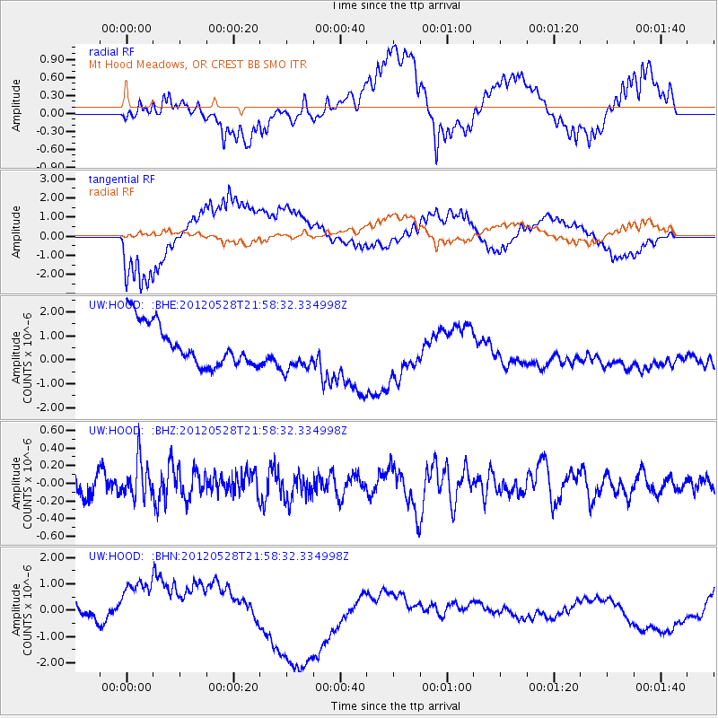
HOOD Mt Hood Meadows, OR CREST BB SMO - Earthquake Result Viewer
*The percent match for this event was below the threshold and hence no stack was calculated.
| Earthquake location: |
Tonga Islands |
| Earthquake latitude/longitude: |
-20.0/-176.0 |
| Earthquake time(UTC): |
2012/05/28 (149) 21:47:09 GMT |
| Earthquake Depth: |
211 km |
| Earthquake Magnitude: |
5.9 MW, 5.3 MB, 5.9 MW |
| Earthquake Catalog/Contributor: |
WHDF/NEIC |
|
| Network: |
UW Pacific Northwest Regional Seismic Network |
| Station: |
HOOD Mt Hood Meadows, OR CREST BB SMO |
| Lat/Lon: |
45.32 N/121.65 W |
| Elevation: |
1520 m |
|
| Distance: |
81.6 deg |
| Az: |
35.405 deg |
| Baz: |
230.574 deg |
| Ray Param: |
$rayparam |
*The percent match for this event was below the threshold and hence was not used in the summary stack. |
|
| Radial Match: |
57.75004 % |
| Radial Bump: |
400 |
| Transverse Match: |
41.1624 % |
| Transverse Bump: |
400 |
| SOD ConfigId: |
455246 |
| Insert Time: |
2012-09-25 00:52:49.969 +0000 |
| GWidth: |
2.5 |
| Max Bumps: |
400 |
| Tol: |
0.001 |
|
Signal To Noise
| Channel | StoN | STA | LTA |
| UW:HOOD: :BHZ:20120528T21:58:32.334998Z | 1.7212456 | 2.1034514E-7 | 1.2220518E-7 |
| UW:HOOD: :BHN:20120528T21:58:32.334998Z | 1.7427291 | 1.2997361E-6 | 7.458051E-7 |
| UW:HOOD: :BHE:20120528T21:58:32.334998Z | 0.9964616 | 8.693182E-7 | 8.7240517E-7 |
| Arrivals |
| Ps | |
| PpPs | |
| PsPs/PpSs | |


