You are here: Home > Network List > UW - Pacific Northwest Regional Seismic Network Stations List
> Station FISH Seaside, OR, USA > Earthquake Result Viewer
FISH Seaside, OR, USA - Earthquake Result Viewer
*The percent match for this event was below the threshold and hence no stack was calculated.
| Earthquake location: |
Tonga Islands |
| Earthquake latitude/longitude: |
-20.0/-176.0 |
| Earthquake time(UTC): |
2012/05/28 (149) 21:47:09 GMT |
| Earthquake Depth: |
211 km |
| Earthquake Magnitude: |
5.9 MW, 5.3 MB, 5.9 MW |
| Earthquake Catalog/Contributor: |
WHDF/NEIC |
|
| Network: |
UW Pacific Northwest Regional Seismic Network |
| Station: |
FISH Seaside, OR, USA |
| Lat/Lon: |
45.93 N/123.56 W |
| Elevation: |
325 m |
|
| Distance: |
80.9 deg |
| Az: |
34.061 deg |
| Baz: |
229.012 deg |
| Ray Param: |
$rayparam |
*The percent match for this event was below the threshold and hence was not used in the summary stack. |
|
| Radial Match: |
28.36999 % |
| Radial Bump: |
400 |
| Transverse Match: |
28.525732 % |
| Transverse Bump: |
400 |
| SOD ConfigId: |
455246 |
| Insert Time: |
2012-09-25 00:52:52.552 +0000 |
| GWidth: |
2.5 |
| Max Bumps: |
400 |
| Tol: |
0.001 |
|
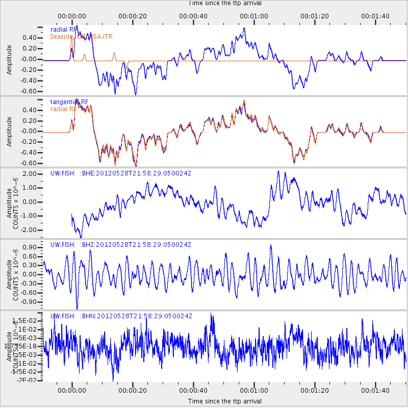
Signal To Noise
| Channel | StoN | STA | LTA |
| UW:FISH: :BHZ:20120528T21:58:29.050024Z | 1.6086091 | 4.9691783E-7 | 3.089115E-7 |
| UW:FISH: :BHN:20120528T21:58:29.050024Z | 1.1389046 | 6.025337E-9 | 5.290467E-9 |
| UW:FISH: :BHE:20120528T21:58:29.050024Z | 1.5366595 | 1.3275089E-6 | 8.6389275E-7 |
| Arrivals |
| Ps | |
| PpPs | |
| PsPs/PpSs | |


