You are here: Home > Network List > TA - USArray Transportable Network (new EarthScope stations) Stations List
> Station N56A West Decatur, PA, USA > Earthquake Result Viewer
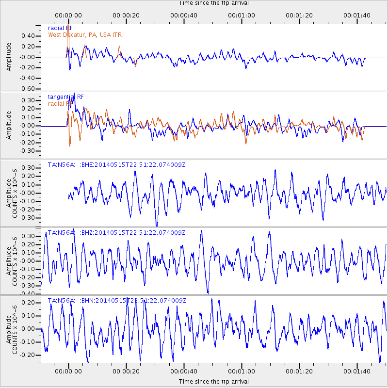
N56A West Decatur, PA, USA - Earthquake Result Viewer
*The percent match for this event was below the threshold and hence no stack was calculated.
| Earthquake location: |
Near Coast Of Northern Peru |
| Earthquake latitude/longitude: |
-7.7/-79.5 |
| Earthquake time(UTC): |
2014/05/15 (135) 22:43:17 GMT |
| Earthquake Depth: |
62 km |
| Earthquake Magnitude: |
5.0 MW |
| Earthquake Catalog/Contributor: |
ISC/ISC |
|
| Network: |
TA USArray Transportable Network (new EarthScope stations) |
| Station: |
N56A West Decatur, PA, USA |
| Lat/Lon: |
40.92 N/78.30 W |
| Elevation: |
561 m |
|
| Distance: |
48.4 deg |
| Az: |
1.184 deg |
| Baz: |
181.549 deg |
| Ray Param: |
$rayparam |
*The percent match for this event was below the threshold and hence was not used in the summary stack. |
|
| Radial Match: |
55.76498 % |
| Radial Bump: |
400 |
| Transverse Match: |
49.748695 % |
| Transverse Bump: |
400 |
| SOD ConfigId: |
3390531 |
| Insert Time: |
2019-04-11 21:50:13.142 +0000 |
| GWidth: |
2.5 |
| Max Bumps: |
400 |
| Tol: |
0.001 |
|
Signal To Noise
| Channel | StoN | STA | LTA |
| TA:N56A: :BHZ:20140515T22:51:22.074009Z | 1.2672014 | 1.930959E-7 | 1.523798E-7 |
| TA:N56A: :BHN:20140515T22:51:22.074009Z | 0.97926015 | 1.1977222E-7 | 1.2230889E-7 |
| TA:N56A: :BHE:20140515T22:51:22.074009Z | 1.9575907 | 1.9652131E-7 | 1.0038938E-7 |
| Arrivals |
| Ps | |
| PpPs | |
| PsPs/PpSs | |


