You are here: Home > Network List > US - United States National Seismic Network Stations List
> Station AMTX Amarillo, Texas, USA > Earthquake Result Viewer
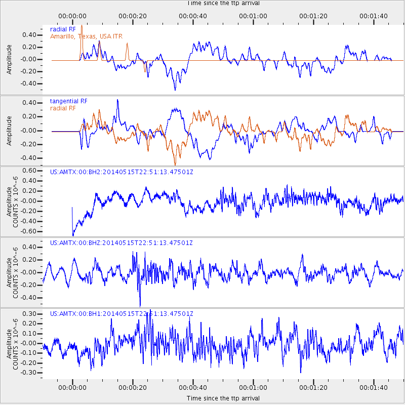
AMTX Amarillo, Texas, USA - Earthquake Result Viewer
*The percent match for this event was below the threshold and hence no stack was calculated.
| Earthquake location: |
Near Coast Of Northern Peru |
| Earthquake latitude/longitude: |
-7.7/-79.5 |
| Earthquake time(UTC): |
2014/05/15 (135) 22:43:17 GMT |
| Earthquake Depth: |
62 km |
| Earthquake Magnitude: |
5.0 MW |
| Earthquake Catalog/Contributor: |
ISC/ISC |
|
| Network: |
US United States National Seismic Network |
| Station: |
AMTX Amarillo, Texas, USA |
| Lat/Lon: |
34.53 N/101.41 W |
| Elevation: |
1010 m |
|
| Distance: |
46.8 deg |
| Az: |
334.969 deg |
| Baz: |
149.472 deg |
| Ray Param: |
$rayparam |
*The percent match for this event was below the threshold and hence was not used in the summary stack. |
|
| Radial Match: |
28.887318 % |
| Radial Bump: |
400 |
| Transverse Match: |
37.6906 % |
| Transverse Bump: |
400 |
| SOD ConfigId: |
3390531 |
| Insert Time: |
2019-04-11 21:50:59.049 +0000 |
| GWidth: |
2.5 |
| Max Bumps: |
400 |
| Tol: |
0.001 |
|
Signal To Noise
| Channel | StoN | STA | LTA |
| US:AMTX:00:BHZ:20140515T22:51:13.47501Z | 1.3123331 | 1.1247092E-7 | 8.5703036E-8 |
| US:AMTX:00:BH1:20140515T22:51:13.47501Z | 1.6102666 | 1.4260439E-7 | 8.855949E-8 |
| US:AMTX:00:BH2:20140515T22:51:13.47501Z | 0.8691997 | 1.9645039E-7 | 2.2601296E-7 |
| Arrivals |
| Ps | |
| PpPs | |
| PsPs/PpSs | |


