You are here: Home > Network List > IW - Intermountain West Stations List
> Station PLID Pearl Lake, Idaho, USA > Earthquake Result Viewer
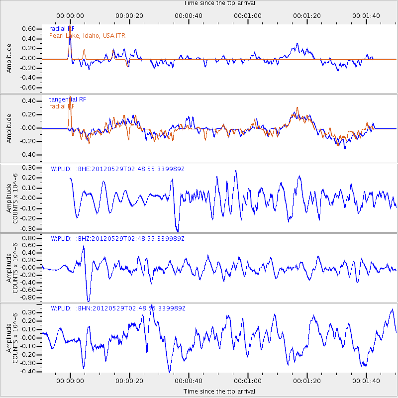
PLID Pearl Lake, Idaho, USA - Earthquake Result Viewer
*The percent match for this event was below the threshold and hence no stack was calculated.
| Earthquake location: |
Komandorskiye Ostrova Region |
| Earthquake latitude/longitude: |
54.4/168.9 |
| Earthquake time(UTC): |
2012/05/29 (150) 02:40:53 GMT |
| Earthquake Depth: |
10 km |
| Earthquake Magnitude: |
5.5 MS, 5.4 MB, 5.6 MW, 5.6 MW |
| Earthquake Catalog/Contributor: |
WHDF/NEIC |
|
| Network: |
IW Intermountain West |
| Station: |
PLID Pearl Lake, Idaho, USA |
| Lat/Lon: |
45.09 N/116.00 W |
| Elevation: |
2164 m |
|
| Distance: |
47.2 deg |
| Az: |
68.832 deg |
| Baz: |
309.619 deg |
| Ray Param: |
$rayparam |
*The percent match for this event was below the threshold and hence was not used in the summary stack. |
|
| Radial Match: |
59.420498 % |
| Radial Bump: |
400 |
| Transverse Match: |
43.34115 % |
| Transverse Bump: |
400 |
| SOD ConfigId: |
455246 |
| Insert Time: |
2012-09-25 01:05:25.082 +0000 |
| GWidth: |
2.5 |
| Max Bumps: |
400 |
| Tol: |
0.001 |
|
Signal To Noise
| Channel | StoN | STA | LTA |
| IW:PLID: :BHZ:20120529T02:48:55.339989Z | 3.189931 | 2.2620559E-7 | 7.091238E-8 |
| IW:PLID: :BHN:20120529T02:48:55.339989Z | 0.85335404 | 1.2688022E-7 | 1.4868417E-7 |
| IW:PLID: :BHE:20120529T02:48:55.339989Z | 0.8834806 | 7.450072E-8 | 8.432638E-8 |
| Arrivals |
| Ps | |
| PpPs | |
| PsPs/PpSs | |


