You are here: Home > Network List > G - GEOSCOPE Stations List
> Station SCZ Chualar Canyon, Santa Cruz, California, U.S.A. > Earthquake Result Viewer
SCZ Chualar Canyon, Santa Cruz, California, U.S.A. - Earthquake Result Viewer

| Earthquake location: |
Hokkaido, Japan Region |
| Earthquake latitude/longitude: |
42.0/139.9 |
| Earthquake time(UTC): |
1993/08/07 (219) 19:42:43 GMT |
| Earthquake Depth: |
26 km |
| Earthquake Magnitude: |
6.2 MB, 6.0 MS, 5.6 UNKNOWN, 6.3 MW |
| Earthquake Catalog/Contributor: |
WHDF/NEIC |
|
| Network: |
G GEOSCOPE |
| Station: |
SCZ Chualar Canyon, Santa Cruz, California, U.S.A. |
| Lat/Lon: |
36.60 N/121.40 W |
| Elevation: |
261 m |
|
| Distance: |
72.3 deg |
| Az: |
56.615 deg |
| Baz: |
309.295 deg |
| Ray Param: |
0.053727154 |
| Estimated Moho Depth: |
47.75 km |
| Estimated Crust Vp/Vs: |
1.73 |
| Assumed Crust Vp: |
6.391 km/s |
| Estimated Crust Vs: |
3.705 km/s |
| Estimated Crust Poisson's Ratio: |
0.25 |
|
| Radial Match: |
95.28917 % |
| Radial Bump: |
400 |
| Transverse Match: |
86.1992 % |
| Transverse Bump: |
400 |
| SOD ConfigId: |
16938 |
| Insert Time: |
2010-02-26 23:48:44.723 +0000 |
| GWidth: |
2.5 |
| Max Bumps: |
400 |
| Tol: |
0.001 |
|
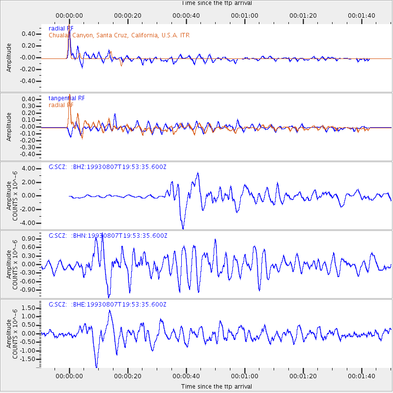
Signal To Noise
| Channel | StoN | STA | LTA |
| G:SCZ: :BHN:19930807T19:53:35.600Z | 1.204956 | 1.1682863E-7 | 9.695676E-8 |
| G:SCZ: :BHE:19930807T19:53:35.600Z | 1.849096 | 2.070258E-7 | 1.1196055E-7 |
| G:SCZ: :BHZ:19930807T19:53:35.600Z | 3.5177987 | 4.6305288E-7 | 1.3163144E-7 |
| Arrivals |
| Ps | 5.6 SECOND |
| PpPs | 20 SECOND |
| PsPs/PpSs | 25 SECOND |


