You are here: Home > Network List > TA - USArray Transportable Network (new EarthScope stations) Stations List
> Station G34A Benson, MN, USA > Earthquake Result Viewer
G34A Benson, MN, USA - Earthquake Result Viewer
*The percent match for this event was below the threshold and hence no stack was calculated.
| Earthquake location: |
Komandorskiye Ostrova Region |
| Earthquake latitude/longitude: |
54.4/168.9 |
| Earthquake time(UTC): |
2012/05/29 (150) 02:40:53 GMT |
| Earthquake Depth: |
10 km |
| Earthquake Magnitude: |
5.5 MS, 5.4 MB, 5.6 MW, 5.6 MW |
| Earthquake Catalog/Contributor: |
WHDF/NEIC |
|
| Network: |
TA USArray Transportable Network (new EarthScope stations) |
| Station: |
G34A Benson, MN, USA |
| Lat/Lon: |
45.24 N/95.64 W |
| Elevation: |
316 m |
|
| Distance: |
57.7 deg |
| Az: |
56.336 deg |
| Baz: |
316.42 deg |
| Ray Param: |
$rayparam |
*The percent match for this event was below the threshold and hence was not used in the summary stack. |
|
| Radial Match: |
73.90002 % |
| Radial Bump: |
400 |
| Transverse Match: |
64.14184 % |
| Transverse Bump: |
400 |
| SOD ConfigId: |
455246 |
| Insert Time: |
2012-09-25 01:16:24.809 +0000 |
| GWidth: |
2.5 |
| Max Bumps: |
400 |
| Tol: |
0.001 |
|
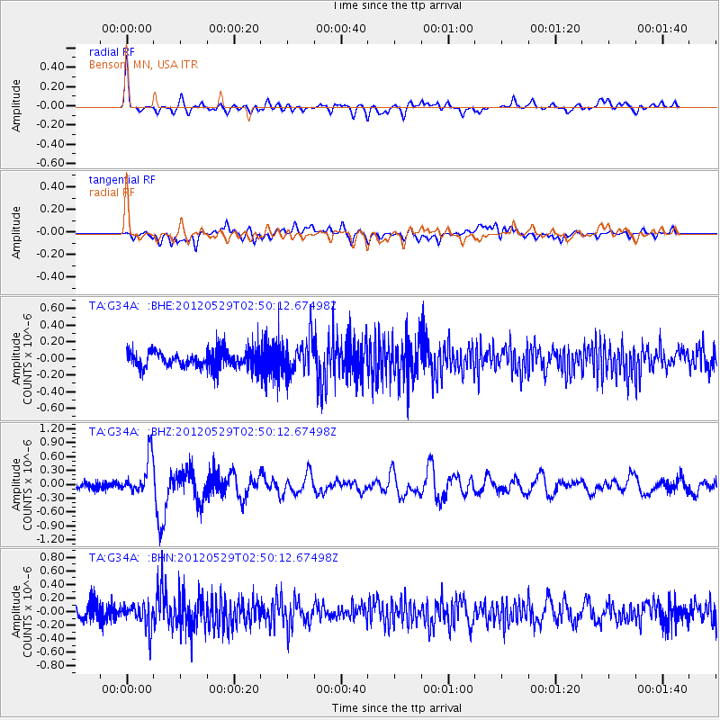
Signal To Noise
| Channel | StoN | STA | LTA |
| TA:G34A: :BHZ:20120529T02:50:12.67498Z | 4.613936 | 4.130695E-7 | 8.952649E-8 |
| TA:G34A: :BHN:20120529T02:50:12.67498Z | 1.9338562 | 1.8994568E-7 | 9.82212E-8 |
| TA:G34A: :BHE:20120529T02:50:12.67498Z | 2.069641 | 2.1121252E-7 | 1.0205273E-7 |
| Arrivals |
| Ps | |
| PpPs | |
| PsPs/PpSs | |


