You are here: Home > Network List > TA - USArray Transportable Network (new EarthScope stations) Stations List
> Station G42A Mountain, WI, USA > Earthquake Result Viewer
G42A Mountain, WI, USA - Earthquake Result Viewer
*The percent match for this event was below the threshold and hence no stack was calculated.
| Earthquake location: |
Komandorskiye Ostrova Region |
| Earthquake latitude/longitude: |
54.4/168.9 |
| Earthquake time(UTC): |
2012/05/29 (150) 02:40:53 GMT |
| Earthquake Depth: |
10 km |
| Earthquake Magnitude: |
5.5 MS, 5.4 MB, 5.6 MW, 5.6 MW |
| Earthquake Catalog/Contributor: |
WHDF/NEIC |
|
| Network: |
TA USArray Transportable Network (new EarthScope stations) |
| Station: |
G42A Mountain, WI, USA |
| Lat/Lon: |
45.24 N/88.43 W |
| Elevation: |
315 m |
|
| Distance: |
61.1 deg |
| Az: |
51.949 deg |
| Baz: |
319.29 deg |
| Ray Param: |
$rayparam |
*The percent match for this event was below the threshold and hence was not used in the summary stack. |
|
| Radial Match: |
71.77058 % |
| Radial Bump: |
400 |
| Transverse Match: |
60.554684 % |
| Transverse Bump: |
400 |
| SOD ConfigId: |
455246 |
| Insert Time: |
2012-09-25 01:33:08.021 +0000 |
| GWidth: |
2.5 |
| Max Bumps: |
400 |
| Tol: |
0.001 |
|
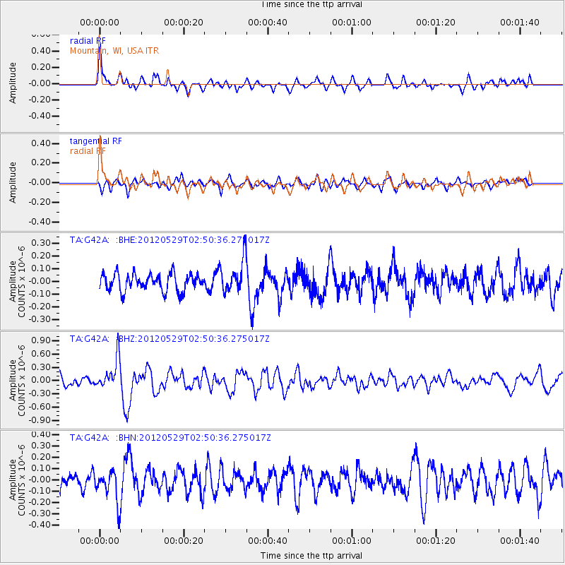
Signal To Noise
| Channel | StoN | STA | LTA |
| TA:G42A: :BHZ:20120529T02:50:36.275017Z | 3.84092 | 3.534244E-7 | 9.201556E-8 |
| TA:G42A: :BHN:20120529T02:50:36.275017Z | 2.3393974 | 1.4563311E-7 | 6.22524E-8 |
| TA:G42A: :BHE:20120529T02:50:36.275017Z | 1.9743971 | 1.3226406E-7 | 6.69896E-8 |
| Arrivals |
| Ps | |
| PpPs | |
| PsPs/PpSs | |


