You are here: Home > Network List > TA - USArray Transportable Network (new EarthScope stations) Stations List
> Station X49A Woodville, AR, USA > Earthquake Result Viewer
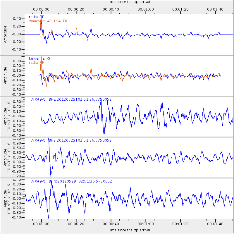
X49A Woodville, AR, USA - Earthquake Result Viewer
*The percent match for this event was below the threshold and hence no stack was calculated.
| Earthquake location: |
Komandorskiye Ostrova Region |
| Earthquake latitude/longitude: |
54.4/168.9 |
| Earthquake time(UTC): |
2012/05/29 (150) 02:40:53 GMT |
| Earthquake Depth: |
10 km |
| Earthquake Magnitude: |
5.5 MS, 5.4 MB, 5.6 MW, 5.6 MW |
| Earthquake Catalog/Contributor: |
WHDF/NEIC |
|
| Network: |
TA USArray Transportable Network (new EarthScope stations) |
| Station: |
X49A Woodville, AR, USA |
| Lat/Lon: |
34.51 N/86.33 W |
| Elevation: |
182 m |
|
| Distance: |
70.5 deg |
| Az: |
57.922 deg |
| Baz: |
323.099 deg |
| Ray Param: |
$rayparam |
*The percent match for this event was below the threshold and hence was not used in the summary stack. |
|
| Radial Match: |
72.57721 % |
| Radial Bump: |
371 |
| Transverse Match: |
65.58192 % |
| Transverse Bump: |
400 |
| SOD ConfigId: |
455246 |
| Insert Time: |
2012-09-25 01:36:44.457 +0000 |
| GWidth: |
2.5 |
| Max Bumps: |
400 |
| Tol: |
0.001 |
|
Signal To Noise
| Channel | StoN | STA | LTA |
| TA:X49A: :BHZ:20120529T02:51:36.575005Z | 4.5387316 | 4.2474358E-7 | 9.3581995E-8 |
| TA:X49A: :BHN:20120529T02:51:36.575005Z | 1.885786 | 1.6940488E-7 | 8.9832504E-8 |
| TA:X49A: :BHE:20120529T02:51:36.575005Z | 2.3471317 | 1.5702464E-7 | 6.6900654E-8 |
| Arrivals |
| Ps | |
| PpPs | |
| PsPs/PpSs | |


