You are here: Home > Network List > BK - Berkeley Digital Seismograph Network Stations List
> Station HUMO Hull Mountain, OR > Earthquake Result Viewer
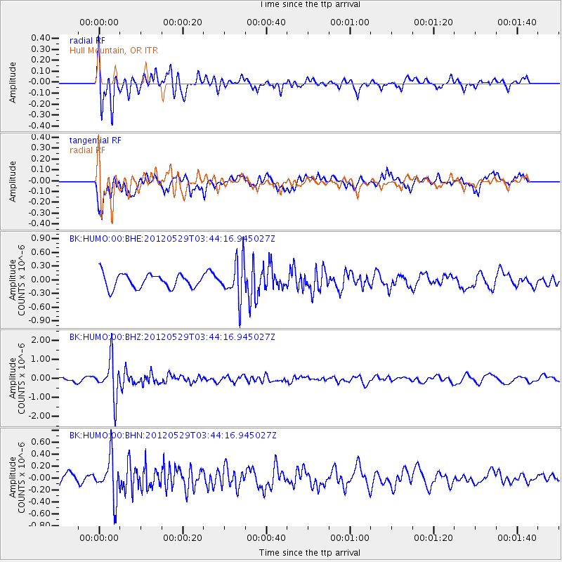
HUMO Hull Mountain, OR - Earthquake Result Viewer
*The percent match for this event was below the threshold and hence no stack was calculated.
| Earthquake location: |
South Of Fiji Islands |
| Earthquake latitude/longitude: |
-22.1/-179.6 |
| Earthquake time(UTC): |
2012/05/29 (150) 03:33:25 GMT |
| Earthquake Depth: |
602 km |
| Earthquake Magnitude: |
5.6 MB, 5.8 MW, 5.9 MW |
| Earthquake Catalog/Contributor: |
WHDF/NEIC |
|
| Network: |
BK Berkeley Digital Seismograph Network |
| Station: |
HUMO Hull Mountain, OR |
| Lat/Lon: |
42.61 N/122.96 W |
| Elevation: |
555 m |
|
| Distance: |
82.9 deg |
| Az: |
38.425 deg |
| Baz: |
231.31 deg |
| Ray Param: |
$rayparam |
*The percent match for this event was below the threshold and hence was not used in the summary stack. |
|
| Radial Match: |
67.45467 % |
| Radial Bump: |
383 |
| Transverse Match: |
74.38613 % |
| Transverse Bump: |
400 |
| SOD ConfigId: |
455246 |
| Insert Time: |
2012-09-25 01:53:38.117 +0000 |
| GWidth: |
2.5 |
| Max Bumps: |
400 |
| Tol: |
0.001 |
|
Signal To Noise
| Channel | StoN | STA | LTA |
| BK:HUMO:00:BHZ:20120529T03:44:16.945027Z | 6.6833053 | 1.0204545E-6 | 1.5268711E-7 |
| BK:HUMO:00:BHN:20120529T03:44:16.945027Z | 3.1751604 | 3.5002387E-7 | 1.1023817E-7 |
| BK:HUMO:00:BHE:20120529T03:44:16.945027Z | 2.7625322 | 4.2005829E-7 | 1.5205553E-7 |
| Arrivals |
| Ps | |
| PpPs | |
| PsPs/PpSs | |


