You are here: Home > Network List > CI - Caltech Regional Seismic Network Stations List
> Station MPP McPhearson Peak > Earthquake Result Viewer
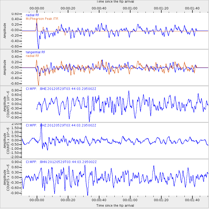
MPP McPhearson Peak - Earthquake Result Viewer
*The percent match for this event was below the threshold and hence no stack was calculated.
| Earthquake location: |
South Of Fiji Islands |
| Earthquake latitude/longitude: |
-22.1/-179.6 |
| Earthquake time(UTC): |
2012/05/29 (150) 03:33:25 GMT |
| Earthquake Depth: |
602 km |
| Earthquake Magnitude: |
5.6 MB, 5.8 MW, 5.9 MW |
| Earthquake Catalog/Contributor: |
WHDF/NEIC |
|
| Network: |
CI Caltech Regional Seismic Network |
| Station: |
MPP McPhearson Peak |
| Lat/Lon: |
34.89 N/119.81 W |
| Elevation: |
1739 m |
|
| Distance: |
80.2 deg |
| Az: |
46.136 deg |
| Baz: |
234.41 deg |
| Ray Param: |
$rayparam |
*The percent match for this event was below the threshold and hence was not used in the summary stack. |
|
| Radial Match: |
59.66721 % |
| Radial Bump: |
400 |
| Transverse Match: |
53.341953 % |
| Transverse Bump: |
400 |
| SOD ConfigId: |
455246 |
| Insert Time: |
2012-09-25 01:56:12.691 +0000 |
| GWidth: |
2.5 |
| Max Bumps: |
400 |
| Tol: |
0.001 |
|
Signal To Noise
| Channel | StoN | STA | LTA |
| CI:MPP: :BHZ:20120529T03:44:03.295002Z | 3.0386455 | 7.3599784E-7 | 2.4221248E-7 |
| CI:MPP: :BHN:20120529T03:44:03.295002Z | 1.2986081 | 3.1066946E-7 | 2.3923266E-7 |
| CI:MPP: :BHE:20120529T03:44:03.295002Z | 1.5199183 | 4.6704508E-7 | 3.07283E-7 |
| Arrivals |
| Ps | |
| PpPs | |
| PsPs/PpSs | |


