You are here: Home > Network List > TA - USArray Transportable Network (new EarthScope stations) Stations List
> Station N23A Red Feather Lakes, CO, USA > Earthquake Result Viewer
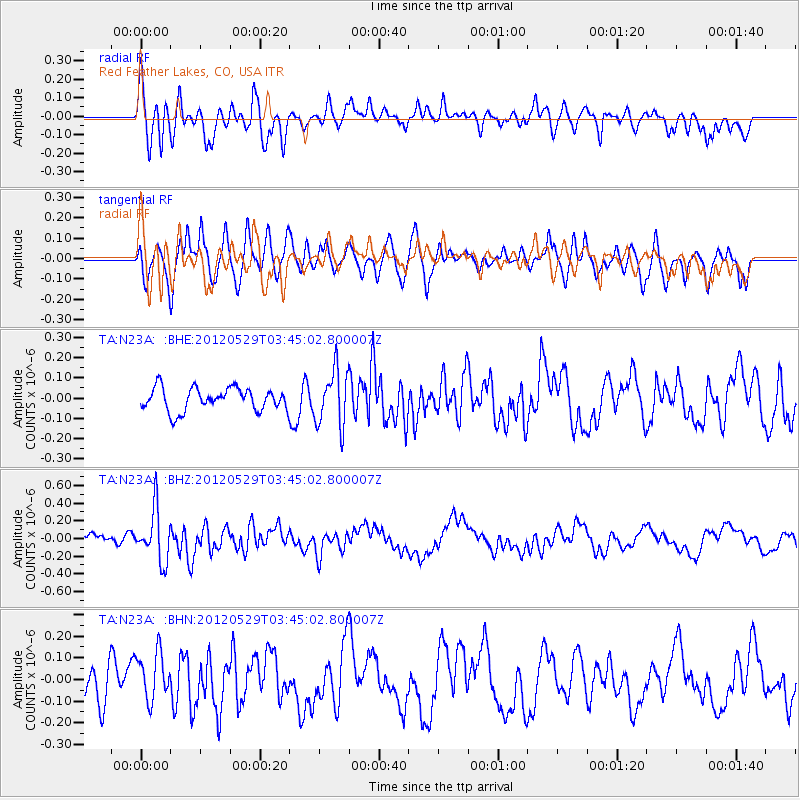
N23A Red Feather Lakes, CO, USA - Earthquake Result Viewer
*The percent match for this event was below the threshold and hence no stack was calculated.
| Earthquake location: |
South Of Fiji Islands |
| Earthquake latitude/longitude: |
-22.1/-179.6 |
| Earthquake time(UTC): |
2012/05/29 (150) 03:33:25 GMT |
| Earthquake Depth: |
602 km |
| Earthquake Magnitude: |
5.6 MB, 5.8 MW, 5.9 MW |
| Earthquake Catalog/Contributor: |
WHDF/NEIC |
|
| Network: |
TA USArray Transportable Network (new EarthScope stations) |
| Station: |
N23A Red Feather Lakes, CO, USA |
| Lat/Lon: |
40.89 N/105.94 W |
| Elevation: |
2458 m |
|
| Distance: |
92.7 deg |
| Az: |
46.742 deg |
| Baz: |
242.968 deg |
| Ray Param: |
$rayparam |
*The percent match for this event was below the threshold and hence was not used in the summary stack. |
|
| Radial Match: |
59.652195 % |
| Radial Bump: |
400 |
| Transverse Match: |
52.54611 % |
| Transverse Bump: |
400 |
| SOD ConfigId: |
455246 |
| Insert Time: |
2012-09-25 02:02:23.362 +0000 |
| GWidth: |
2.5 |
| Max Bumps: |
400 |
| Tol: |
0.001 |
|
Signal To Noise
| Channel | StoN | STA | LTA |
| TA:N23A: :BHZ:20120529T03:45:02.800007Z | 2.8019571 | 2.9179705E-7 | 1.0414044E-7 |
| TA:N23A: :BHN:20120529T03:45:02.800007Z | 1.3405427 | 1.1129982E-7 | 8.3025945E-8 |
| TA:N23A: :BHE:20120529T03:45:02.800007Z | 2.4623284 | 1.3795216E-7 | 5.6025083E-8 |
| Arrivals |
| Ps | |
| PpPs | |
| PsPs/PpSs | |


