You are here: Home > Network List > TA - USArray Transportable Network (new EarthScope stations) Stations List
> Station J04D Umpqua National Forest, Toketee, OR, USA > Earthquake Result Viewer
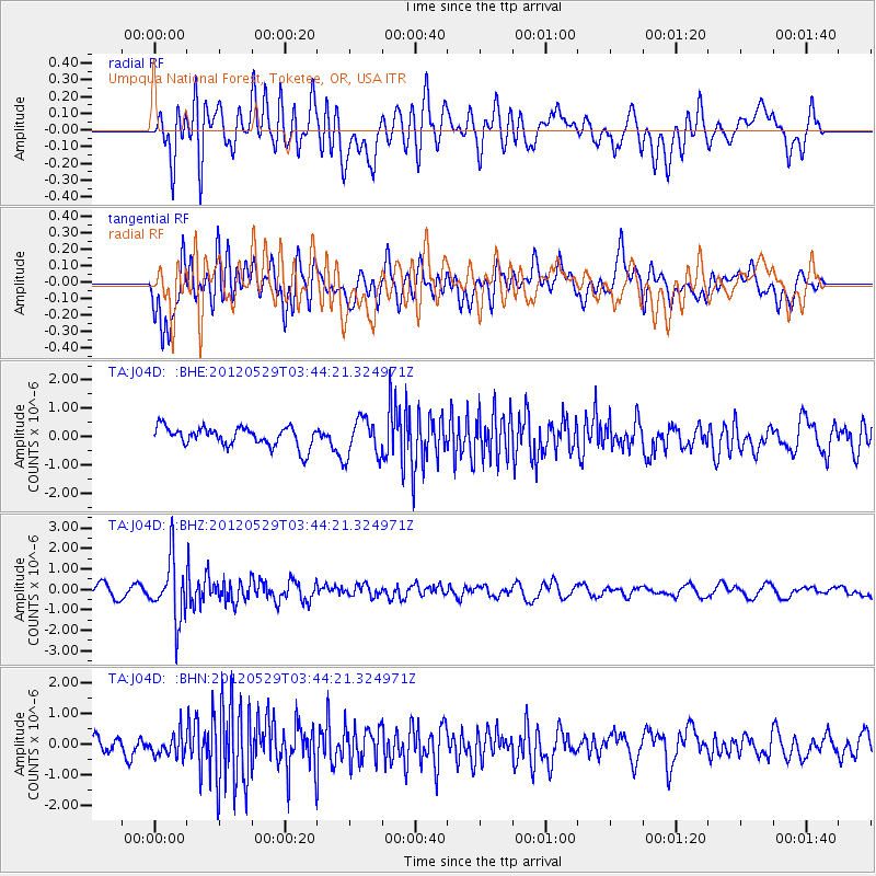
J04D Umpqua National Forest, Toketee, OR, USA - Earthquake Result Viewer
*The percent match for this event was below the threshold and hence no stack was calculated.
| Earthquake location: |
South Of Fiji Islands |
| Earthquake latitude/longitude: |
-22.1/-179.6 |
| Earthquake time(UTC): |
2012/05/29 (150) 03:33:25 GMT |
| Earthquake Depth: |
602 km |
| Earthquake Magnitude: |
5.6 MB, 5.8 MW, 5.9 MW |
| Earthquake Catalog/Contributor: |
WHDF/NEIC |
|
| Network: |
TA USArray Transportable Network (new EarthScope stations) |
| Station: |
J04D Umpqua National Forest, Toketee, OR, USA |
| Lat/Lon: |
43.24 N/122.11 W |
| Elevation: |
1948 m |
|
| Distance: |
83.8 deg |
| Az: |
38.315 deg |
| Baz: |
231.873 deg |
| Ray Param: |
$rayparam |
*The percent match for this event was below the threshold and hence was not used in the summary stack. |
|
| Radial Match: |
64.946594 % |
| Radial Bump: |
400 |
| Transverse Match: |
72.59681 % |
| Transverse Bump: |
400 |
| SOD ConfigId: |
455246 |
| Insert Time: |
2012-09-25 02:02:55.363 +0000 |
| GWidth: |
2.5 |
| Max Bumps: |
400 |
| Tol: |
0.001 |
|
Signal To Noise
| Channel | StoN | STA | LTA |
| TA:J04D: :BHZ:20120529T03:44:21.324971Z | 5.553668 | 1.4770458E-6 | 2.659586E-7 |
| TA:J04D: :BHN:20120529T03:44:21.324971Z | 1.5046971 | 3.7127637E-7 | 2.4674492E-7 |
| TA:J04D: :BHE:20120529T03:44:21.324971Z | 1.958226 | 6.748256E-7 | 3.4461073E-7 |
| Arrivals |
| Ps | |
| PpPs | |
| PsPs/PpSs | |


