You are here: Home > Network List > TA - USArray Transportable Network (new EarthScope stations) Stations List
> Station L02D Cave Junction, OR, USA > Earthquake Result Viewer
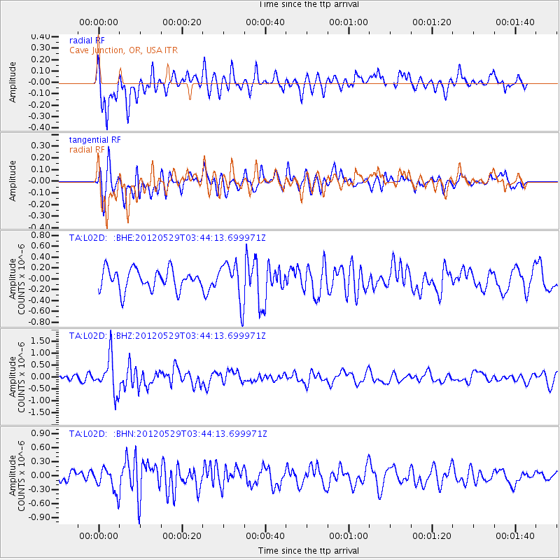
L02D Cave Junction, OR, USA - Earthquake Result Viewer
*The percent match for this event was below the threshold and hence no stack was calculated.
| Earthquake location: |
South Of Fiji Islands |
| Earthquake latitude/longitude: |
-22.1/-179.6 |
| Earthquake time(UTC): |
2012/05/29 (150) 03:33:25 GMT |
| Earthquake Depth: |
602 km |
| Earthquake Magnitude: |
5.6 MB, 5.8 MW, 5.9 MW |
| Earthquake Catalog/Contributor: |
WHDF/NEIC |
|
| Network: |
TA USArray Transportable Network (new EarthScope stations) |
| Station: |
L02D Cave Junction, OR, USA |
| Lat/Lon: |
42.16 N/123.60 W |
| Elevation: |
458 m |
|
| Distance: |
82.2 deg |
| Az: |
38.474 deg |
| Baz: |
230.883 deg |
| Ray Param: |
$rayparam |
*The percent match for this event was below the threshold and hence was not used in the summary stack. |
|
| Radial Match: |
70.87657 % |
| Radial Bump: |
400 |
| Transverse Match: |
54.36506 % |
| Transverse Bump: |
400 |
| SOD ConfigId: |
455246 |
| Insert Time: |
2012-09-25 02:03:40.900 +0000 |
| GWidth: |
2.5 |
| Max Bumps: |
400 |
| Tol: |
0.001 |
|
Signal To Noise
| Channel | StoN | STA | LTA |
| TA:L02D: :BHZ:20120529T03:44:13.699971Z | 4.6492157 | 7.6873874E-7 | 1.6534804E-7 |
| TA:L02D: :BHN:20120529T03:44:13.699971Z | 2.1279864 | 2.6462666E-7 | 1.2435542E-7 |
| TA:L02D: :BHE:20120529T03:44:13.699971Z | 2.0087702 | 3.7481144E-7 | 1.8658753E-7 |
| Arrivals |
| Ps | |
| PpPs | |
| PsPs/PpSs | |


