You are here: Home > Network List > CI - Caltech Regional Seismic Network Stations List
> Station LGU LGU, Camarillo, CA, USA > Earthquake Result Viewer
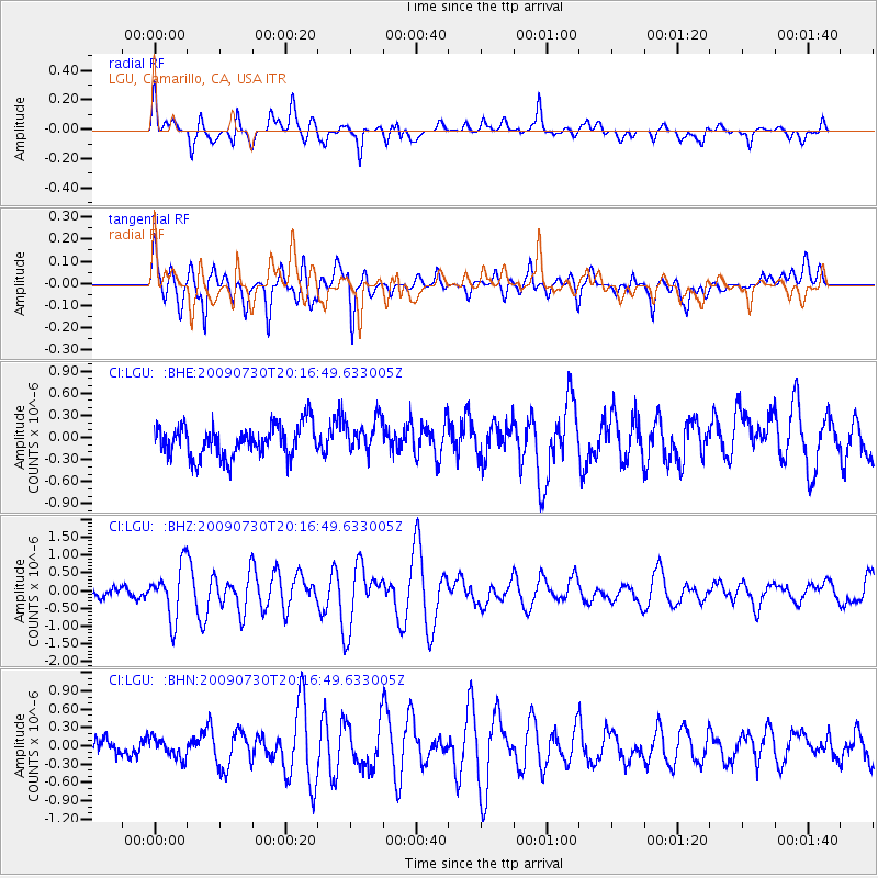
LGU LGU, Camarillo, CA, USA - Earthquake Result Viewer
*The percent match for this event was below the threshold and hence no stack was calculated.
| Earthquake location: |
Tonga Islands |
| Earthquake latitude/longitude: |
-20.8/-174.3 |
| Earthquake time(UTC): |
2009/07/30 (211) 20:05:34 GMT |
| Earthquake Depth: |
10 km |
| Earthquake Magnitude: |
5.9 MB, 5.7 MS, 5.8 MW, 5.7 MW |
| Earthquake Catalog/Contributor: |
WHDF/NEIC |
|
| Network: |
CI Caltech Regional Seismic Network |
| Station: |
LGU LGU, Camarillo, CA, USA |
| Lat/Lon: |
34.11 N/119.07 W |
| Elevation: |
416 m |
|
| Distance: |
75.8 deg |
| Az: |
44.647 deg |
| Baz: |
232.389 deg |
| Ray Param: |
$rayparam |
*The percent match for this event was below the threshold and hence was not used in the summary stack. |
|
| Radial Match: |
80.88114 % |
| Radial Bump: |
400 |
| Transverse Match: |
79.79662 % |
| Transverse Bump: |
400 |
| SOD ConfigId: |
2622 |
| Insert Time: |
2010-02-25 20:22:24.639 +0000 |
| GWidth: |
2.5 |
| Max Bumps: |
400 |
| Tol: |
0.001 |
|
Signal To Noise
| Channel | StoN | STA | LTA |
| CI:LGU: :BHZ:20090730T20:16:49.633005Z | 6.9150944 | 7.3032766E-7 | 1.0561355E-7 |
| CI:LGU: :BHN:20090730T20:16:49.633005Z | 1.1960988 | 1.5899674E-7 | 1.3292943E-7 |
| CI:LGU: :BHE:20090730T20:16:49.633005Z | 1.036955 | 2.2411629E-7 | 2.1612922E-7 |
| Arrivals |
| Ps | |
| PpPs | |
| PsPs/PpSs | |


