You are here: Home > Network List > TA - USArray Transportable Network (new EarthScope stations) Stations List
> Station O03D Paynes Creek, CA, USA > Earthquake Result Viewer
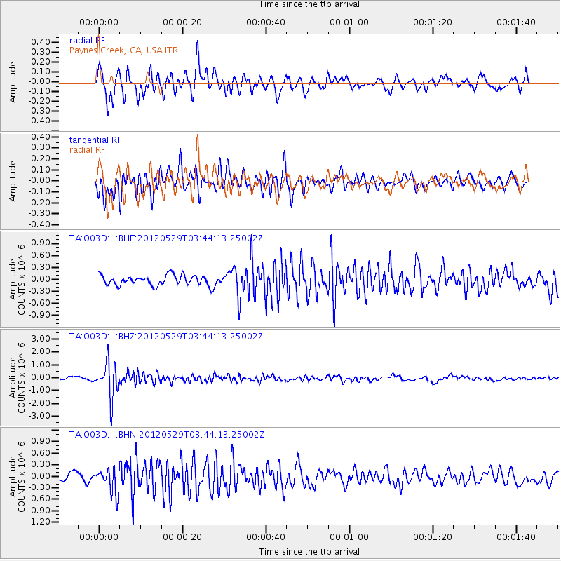
O03D Paynes Creek, CA, USA - Earthquake Result Viewer
*The percent match for this event was below the threshold and hence no stack was calculated.
| Earthquake location: |
South Of Fiji Islands |
| Earthquake latitude/longitude: |
-22.1/-179.6 |
| Earthquake time(UTC): |
2012/05/29 (150) 03:33:25 GMT |
| Earthquake Depth: |
602 km |
| Earthquake Magnitude: |
5.6 MB, 5.8 MW, 5.9 MW |
| Earthquake Catalog/Contributor: |
WHDF/NEIC |
|
| Network: |
TA USArray Transportable Network (new EarthScope stations) |
| Station: |
O03D Paynes Creek, CA, USA |
| Lat/Lon: |
40.29 N/121.80 W |
| Elevation: |
968 m |
|
| Distance: |
82.2 deg |
| Az: |
40.799 deg |
| Baz: |
232.381 deg |
| Ray Param: |
$rayparam |
*The percent match for this event was below the threshold and hence was not used in the summary stack. |
|
| Radial Match: |
78.470024 % |
| Radial Bump: |
400 |
| Transverse Match: |
78.69966 % |
| Transverse Bump: |
400 |
| SOD ConfigId: |
455246 |
| Insert Time: |
2012-09-25 02:04:13.483 +0000 |
| GWidth: |
2.5 |
| Max Bumps: |
400 |
| Tol: |
0.001 |
|
Signal To Noise
| Channel | StoN | STA | LTA |
| TA:O03D: :BHZ:20120529T03:44:13.25002Z | 10.870125 | 1.3244282E-6 | 1.2184113E-7 |
| TA:O03D: :BHN:20120529T03:44:13.25002Z | 3.0346646 | 3.1585645E-7 | 1.0408282E-7 |
| TA:O03D: :BHE:20120529T03:44:13.25002Z | 2.78993 | 3.2290095E-7 | 1.15738004E-7 |
| Arrivals |
| Ps | |
| PpPs | |
| PsPs/PpSs | |


