You are here: Home > Network List > UW - Pacific Northwest Regional Seismic Network Stations List
> Station MRBL Marblemount, WA, USA > Earthquake Result Viewer
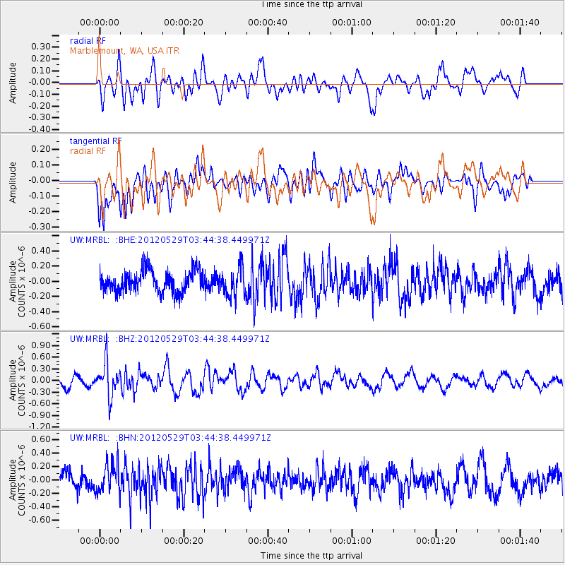
MRBL Marblemount, WA, USA - Earthquake Result Viewer
*The percent match for this event was below the threshold and hence no stack was calculated.
| Earthquake location: |
South Of Fiji Islands |
| Earthquake latitude/longitude: |
-22.1/-179.6 |
| Earthquake time(UTC): |
2012/05/29 (150) 03:33:25 GMT |
| Earthquake Depth: |
602 km |
| Earthquake Magnitude: |
5.6 MB, 5.8 MW, 5.9 MW |
| Earthquake Catalog/Contributor: |
WHDF/NEIC |
|
| Network: |
UW Pacific Northwest Regional Seismic Network |
| Station: |
MRBL Marblemount, WA, USA |
| Lat/Lon: |
48.52 N/121.48 W |
| Elevation: |
75 m |
|
| Distance: |
87.4 deg |
| Az: |
34.417 deg |
| Baz: |
232.019 deg |
| Ray Param: |
$rayparam |
*The percent match for this event was below the threshold and hence was not used in the summary stack. |
|
| Radial Match: |
62.35291 % |
| Radial Bump: |
400 |
| Transverse Match: |
72.17407 % |
| Transverse Bump: |
400 |
| SOD ConfigId: |
455246 |
| Insert Time: |
2012-09-25 02:07:08.735 +0000 |
| GWidth: |
2.5 |
| Max Bumps: |
400 |
| Tol: |
0.001 |
|
Signal To Noise
| Channel | StoN | STA | LTA |
| UW:MRBL: :BHZ:20120529T03:44:38.449971Z | 3.0616586 | 4.4745428E-7 | 1.4614767E-7 |
| UW:MRBL: :BHN:20120529T03:44:38.449971Z | 1.7689984 | 2.1377319E-7 | 1.208442E-7 |
| UW:MRBL: :BHE:20120529T03:44:38.449971Z | 1.3657935 | 1.9261577E-7 | 1.4102848E-7 |
| Arrivals |
| Ps | |
| PpPs | |
| PsPs/PpSs | |


