You are here: Home > Network List > G - GEOSCOPE Stations List
> Station SCZ Chualar Canyon, Santa Cruz, California, U.S.A. > Earthquake Result Viewer
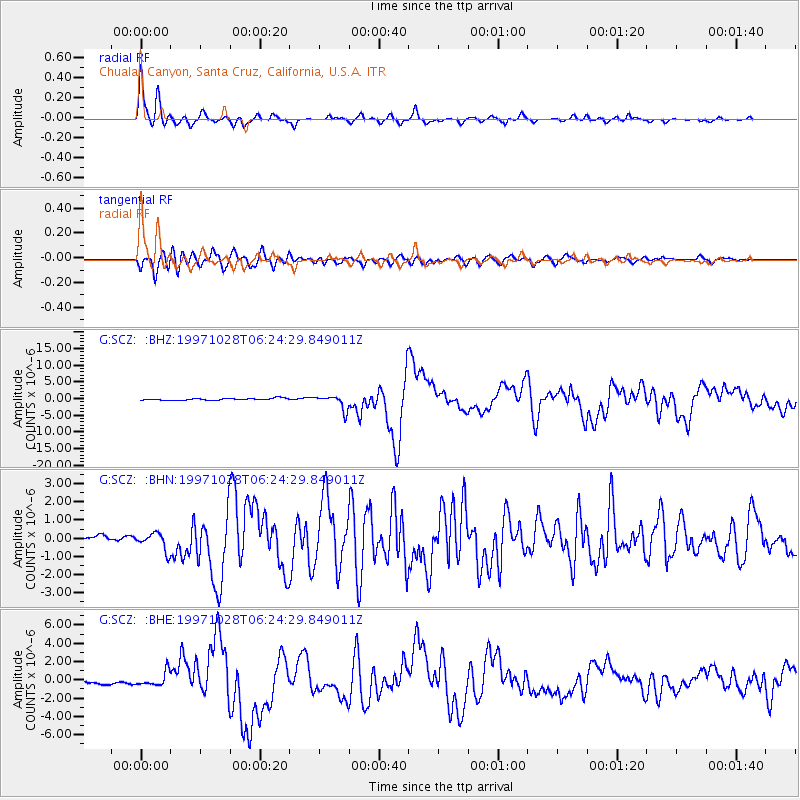
SCZ Chualar Canyon, Santa Cruz, California, U.S.A. - Earthquake Result Viewer

| Earthquake location: |
Northern Peru |
| Earthquake latitude/longitude: |
-4.4/-76.7 |
| Earthquake time(UTC): |
1997/10/28 (301) 06:15:17 GMT |
| Earthquake Depth: |
112 km |
| Earthquake Magnitude: |
6.6 MB, 6.3 MS, 7.2 UNKNOWN, 6.6 ME |
| Earthquake Catalog/Contributor: |
WHDF/NEIC |
|
| Network: |
G GEOSCOPE |
| Station: |
SCZ Chualar Canyon, Santa Cruz, California, U.S.A. |
| Lat/Lon: |
36.60 N/121.40 W |
| Elevation: |
261 m |
|
| Distance: |
58.3 deg |
| Az: |
318.282 deg |
| Baz: |
124.457 deg |
| Ray Param: |
0.06259177 |
| Estimated Moho Depth: |
25.75 km |
| Estimated Crust Vp/Vs: |
1.66 |
| Assumed Crust Vp: |
6.391 km/s |
| Estimated Crust Vs: |
3.856 km/s |
| Estimated Crust Poisson's Ratio: |
0.21 |
|
| Radial Match: |
96.03062 % |
| Radial Bump: |
285 |
| Transverse Match: |
90.10489 % |
| Transverse Bump: |
400 |
| SOD ConfigId: |
6273 |
| Insert Time: |
2010-02-26 23:51:15.468 +0000 |
| GWidth: |
2.5 |
| Max Bumps: |
400 |
| Tol: |
0.001 |
|
Signal To Noise
| Channel | StoN | STA | LTA |
| G:SCZ: :BHN:19971028T06:24:29.849011Z | 3.3346715 | 4.8415404E-7 | 1.4518793E-7 |
| G:SCZ: :BHE:19971028T06:24:29.849011Z | 4.312458 | 7.5772243E-7 | 1.7570547E-7 |
| G:SCZ: :BHZ:19971028T06:24:29.849011Z | 8.070079 | 2.1917922E-6 | 2.715949E-7 |
| Arrivals |
| Ps | 2.8 SECOND |
| PpPs | 10 SECOND |
| PsPs/PpSs | 13 SECOND |


