You are here: Home > Network List > TA - USArray Transportable Network (new EarthScope stations) Stations List
> Station U46A Springville, TN, USA > Earthquake Result Viewer
U46A Springville, TN, USA - Earthquake Result Viewer

| Earthquake location: |
Northern Italy |
| Earthquake latitude/longitude: |
44.9/11.1 |
| Earthquake time(UTC): |
2012/05/29 (150) 07:00:03 GMT |
| Earthquake Depth: |
10 km |
| Earthquake Magnitude: |
5.9 MB, 5.8 MS, 5.8 MW, 5.8 MW |
| Earthquake Catalog/Contributor: |
WHDF/NEIC |
|
| Network: |
TA USArray Transportable Network (new EarthScope stations) |
| Station: |
U46A Springville, TN, USA |
| Lat/Lon: |
36.36 N/88.18 W |
| Elevation: |
146 m |
|
| Distance: |
71.2 deg |
| Az: |
302.686 deg |
| Baz: |
47.872 deg |
| Ray Param: |
0.054488122 |
| Estimated Moho Depth: |
14.75 km |
| Estimated Crust Vp/Vs: |
1.62 |
| Assumed Crust Vp: |
6.444 km/s |
| Estimated Crust Vs: |
3.978 km/s |
| Estimated Crust Poisson's Ratio: |
0.19 |
|
| Radial Match: |
80.97187 % |
| Radial Bump: |
400 |
| Transverse Match: |
74.25817 % |
| Transverse Bump: |
400 |
| SOD ConfigId: |
455246 |
| Insert Time: |
2012-09-25 02:49:38.301 +0000 |
| GWidth: |
2.5 |
| Max Bumps: |
400 |
| Tol: |
0.001 |
|
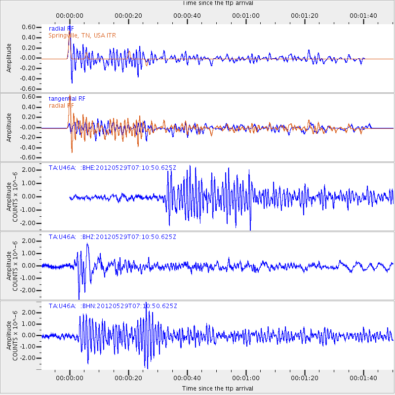
Signal To Noise
| Channel | StoN | STA | LTA |
| TA:U46A: :BHZ:20120529T07:10:50.625Z | 7.6518254 | 7.7463835E-7 | 1.0123576E-7 |
| TA:U46A: :BHN:20120529T07:10:50.625Z | 6.9628773 | 6.52287E-7 | 9.3680676E-8 |
| TA:U46A: :BHE:20120529T07:10:50.625Z | 6.719833 | 8.0778267E-7 | 1.2020875E-7 |
| Arrivals |
| Ps | 1.5 SECOND |
| PpPs | 5.8 SECOND |
| PsPs/PpSs | 7.2 SECOND |


