You are here: Home > Network List > G - GEOSCOPE Stations List
> Station SCZ Chualar Canyon, Santa Cruz, California, U.S.A. > Earthquake Result Viewer
SCZ Chualar Canyon, Santa Cruz, California, U.S.A. - Earthquake Result Viewer

| Earthquake location: |
Andreanof Islands, Aleutian Is. |
| Earthquake latitude/longitude: |
51.4/-178.1 |
| Earthquake time(UTC): |
2000/04/21 (112) 04:35:17 GMT |
| Earthquake Depth: |
33 km |
| Earthquake Magnitude: |
6.0 MB, 5.7 MS, 6.2 ML, 6.0 MW |
| Earthquake Catalog/Contributor: |
WHDF/NEIC |
|
| Network: |
G GEOSCOPE |
| Station: |
SCZ Chualar Canyon, Santa Cruz, California, U.S.A. |
| Lat/Lon: |
36.60 N/121.40 W |
| Elevation: |
261 m |
|
| Distance: |
42.3 deg |
| Az: |
87.66 deg |
| Baz: |
308.976 deg |
| Ray Param: |
0.073174 |
| Estimated Moho Depth: |
30.5 km |
| Estimated Crust Vp/Vs: |
2.10 |
| Assumed Crust Vp: |
6.391 km/s |
| Estimated Crust Vs: |
3.047 km/s |
| Estimated Crust Poisson's Ratio: |
0.35 |
|
| Radial Match: |
82.344215 % |
| Radial Bump: |
358 |
| Transverse Match: |
76.07284 % |
| Transverse Bump: |
398 |
| SOD ConfigId: |
3744 |
| Insert Time: |
2010-02-26 23:51:59.551 +0000 |
| GWidth: |
2.5 |
| Max Bumps: |
400 |
| Tol: |
0.001 |
|
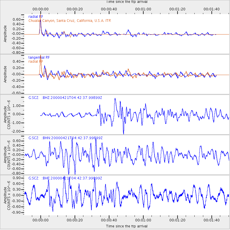
Signal To Noise
| Channel | StoN | STA | LTA |
| G:SCZ: :BHN:20000421T04:42:37.99899Z | 2.1955693 | 1.9020564E-7 | 8.663159E-8 |
| G:SCZ: :BHE:20000421T04:42:37.99899Z | 1.7426411 | 2.880197E-7 | 1.652777E-7 |
| G:SCZ: :BHZ:20000421T04:42:37.99899Z | 2.6980088 | 3.8746003E-7 | 1.4360963E-7 |
| Arrivals |
| Ps | 5.5 SECOND |
| PpPs | 14 SECOND |
| PsPs/PpSs | 20 SECOND |


