You are here: Home > Network List > GM - US Geological Survey Networks Stations List
> Station IWM01 Jericho 2M Well Monitoring Station > Earthquake Result Viewer
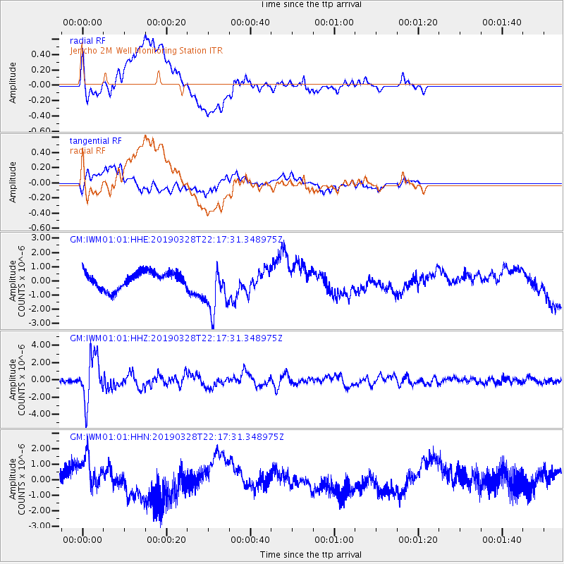
IWM01 Jericho 2M Well Monitoring Station - Earthquake Result Viewer
*The percent match for this event was below the threshold and hence no stack was calculated.
| Earthquake location: |
East Of Kuril Islands |
| Earthquake latitude/longitude: |
50.5/160.0 |
| Earthquake time(UTC): |
2019/03/28 (087) 22:06:49 GMT |
| Earthquake Depth: |
9.0 km |
| Earthquake Magnitude: |
6.2 Mww |
| Earthquake Catalog/Contributor: |
NEIC PDE/us |
|
| Network: |
GM US Geological Survey Networks |
| Station: |
IWM01 Jericho 2M Well Monitoring Station |
| Lat/Lon: |
36.73 N/96.53 W |
| Elevation: |
328 m |
|
| Distance: |
70.2 deg |
| Az: |
56.117 deg |
| Baz: |
318.711 deg |
| Ray Param: |
$rayparam |
*The percent match for this event was below the threshold and hence was not used in the summary stack. |
|
| Radial Match: |
37.55845 % |
| Radial Bump: |
400 |
| Transverse Match: |
32.310127 % |
| Transverse Bump: |
400 |
| SOD ConfigId: |
3426611 |
| Insert Time: |
2019-04-11 22:17:13.936 +0000 |
| GWidth: |
2.5 |
| Max Bumps: |
400 |
| Tol: |
0.001 |
|
Signal To Noise
| Channel | StoN | STA | LTA |
| GM:IWM01:01:HHZ:20190328T22:17:31.348975Z | 14.786267 | 2.6819612E-6 | 1.8138189E-7 |
| GM:IWM01:01:HHN:20190328T22:17:31.348975Z | 1.5608052 | 1.0624339E-6 | 6.8069596E-7 |
| GM:IWM01:01:HHE:20190328T22:17:31.348975Z | 2.9119668 | 1.7047513E-6 | 5.854295E-7 |
| Arrivals |
| Ps | |
| PpPs | |
| PsPs/PpSs | |


