You are here: Home > Network List > G - GEOSCOPE Stations List
> Station TAM Tamanrasset, Algeria > Earthquake Result Viewer
TAM Tamanrasset, Algeria - Earthquake Result Viewer
*The percent match for this event was below the threshold and hence no stack was calculated.
| Earthquake location: |
Lake Issyk-Kul Region |
| Earthquake latitude/longitude: |
43.4/78.7 |
| Earthquake time(UTC): |
2012/05/30 (151) 21:20:56 GMT |
| Earthquake Depth: |
17 km |
| Earthquake Magnitude: |
5.7 MB, 5.4 MW, 5.3 MW |
| Earthquake Catalog/Contributor: |
WHDF/NEIC |
|
| Network: |
G GEOSCOPE |
| Station: |
TAM Tamanrasset, Algeria |
| Lat/Lon: |
22.79 N/5.53 E |
| Elevation: |
1377 m |
|
| Distance: |
62.7 deg |
| Az: |
276.357 deg |
| Baz: |
51.735 deg |
| Ray Param: |
$rayparam |
*The percent match for this event was below the threshold and hence was not used in the summary stack. |
|
| Radial Match: |
61.68974 % |
| Radial Bump: |
400 |
| Transverse Match: |
53.702488 % |
| Transverse Bump: |
400 |
| SOD ConfigId: |
455246 |
| Insert Time: |
2012-09-25 03:58:42.895 +0000 |
| GWidth: |
2.5 |
| Max Bumps: |
400 |
| Tol: |
0.001 |
|
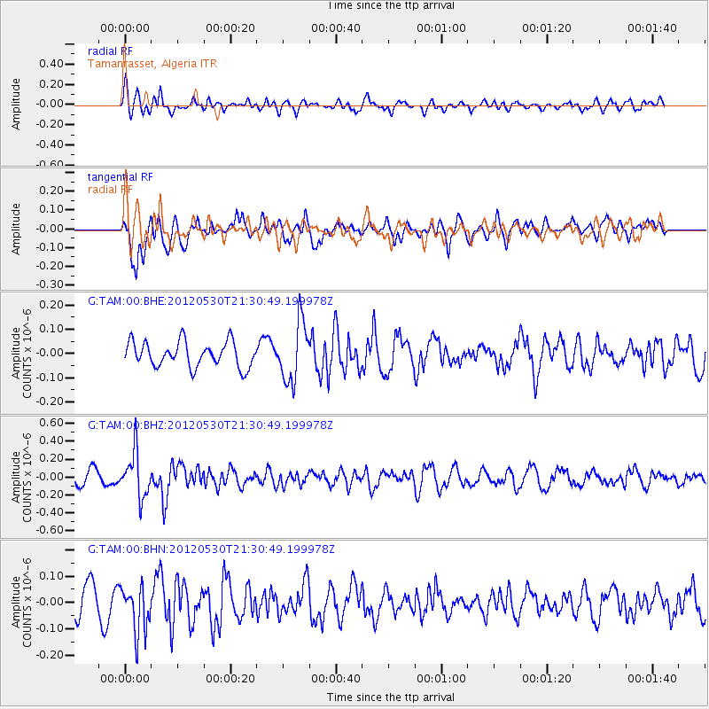
Signal To Noise
| Channel | StoN | STA | LTA |
| G:TAM:00:BHZ:20120530T21:30:49.199978Z | 3.0532818 | 2.520143E-7 | 8.2538826E-8 |
| G:TAM:00:BHN:20120530T21:30:49.199978Z | 1.4555519 | 9.1282956E-8 | 6.271364E-8 |
| G:TAM:00:BHE:20120530T21:30:49.199978Z | 2.399082 | 1.2386323E-7 | 5.1629424E-8 |
| Arrivals |
| Ps | |
| PpPs | |
| PsPs/PpSs | |


