You are here: Home > Network List > G - GEOSCOPE Stations List
> Station SCZ Chualar Canyon, Santa Cruz, California, U.S.A. > Earthquake Result Viewer
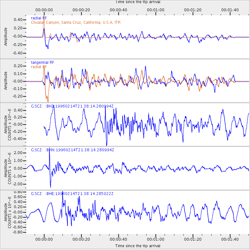
SCZ Chualar Canyon, Santa Cruz, California, U.S.A. - Earthquake Result Viewer
*The percent match for this event was below the threshold and hence no stack was calculated.
| Earthquake location: |
Southeast Of Honshu, Japan |
| Earthquake latitude/longitude: |
29.2/140.4 |
| Earthquake time(UTC): |
1996/02/14 (045) 21:26:56 GMT |
| Earthquake Depth: |
142 km |
| Earthquake Magnitude: |
5.9 MB |
| Earthquake Catalog/Contributor: |
WHDF/NEIC |
|
| Network: |
G GEOSCOPE |
| Station: |
SCZ Chualar Canyon, Santa Cruz, California, U.S.A. |
| Lat/Lon: |
36.60 N/121.40 W |
| Elevation: |
261 m |
|
| Distance: |
79.2 deg |
| Az: |
54.186 deg |
| Baz: |
298.255 deg |
| Ray Param: |
$rayparam |
*The percent match for this event was below the threshold and hence was not used in the summary stack. |
|
| Radial Match: |
62.532948 % |
| Radial Bump: |
400 |
| Transverse Match: |
60.15832 % |
| Transverse Bump: |
400 |
| SOD ConfigId: |
4480 |
| Insert Time: |
2010-02-26 23:53:48.463 +0000 |
| GWidth: |
2.5 |
| Max Bumps: |
400 |
| Tol: |
0.001 |
|
Signal To Noise
| Channel | StoN | STA | LTA |
| G:SCZ: :BHN:19960214T21:38:14.280994Z | 3.3698971 | 8.838614E-7 | 2.6228142E-7 |
| G:SCZ: :BHE:19960214T21:38:14.285022Z | 1.6106822 | 2.868427E-7 | 1.7808769E-7 |
| G:SCZ: :BHZ:19960214T21:38:14.280994Z | 1.2476482 | 2.59757E-7 | 2.081973E-7 |
| Arrivals |
| Ps | |
| PpPs | |
| PsPs/PpSs | |


