You are here: Home > Network List > GS - US Geological Survey Networks Stations List
> Station KAN10 Keim Farm > Earthquake Result Viewer
KAN10 Keim Farm - Earthquake Result Viewer
*The percent match for this event was below the threshold and hence no stack was calculated.
| Earthquake location: |
Near Coast Of Northern Chile |
| Earthquake latitude/longitude: |
-20.0/-70.9 |
| Earthquake time(UTC): |
2014/05/17 (137) 09:11:06 GMT |
| Earthquake Depth: |
13 km |
| Earthquake Magnitude: |
5.5 MB |
| Earthquake Catalog/Contributor: |
NEIC PDE/NEIC COMCAT |
|
| Network: |
GS US Geological Survey Networks |
| Station: |
KAN10 Keim Farm |
| Lat/Lon: |
37.12 N/98.10 W |
| Elevation: |
417 m |
|
| Distance: |
62.4 deg |
| Az: |
335.648 deg |
| Baz: |
150.98 deg |
| Ray Param: |
$rayparam |
*The percent match for this event was below the threshold and hence was not used in the summary stack. |
|
| Radial Match: |
35.913624 % |
| Radial Bump: |
400 |
| Transverse Match: |
25.009138 % |
| Transverse Bump: |
400 |
| SOD ConfigId: |
3390531 |
| Insert Time: |
2019-04-11 22:21:09.626 +0000 |
| GWidth: |
2.5 |
| Max Bumps: |
400 |
| Tol: |
0.001 |
|
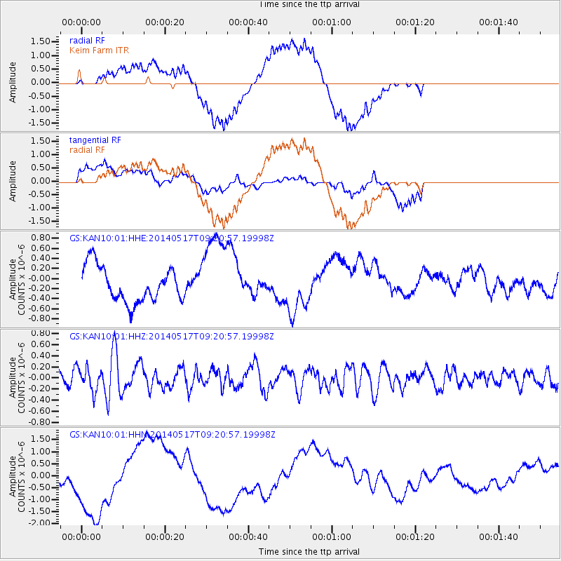
Signal To Noise
| Channel | StoN | STA | LTA |
| GS:KAN10:01:HHZ:20140517T09:20:57.19998Z | 1.4416018 | 2.0235952E-7 | 1.403713E-7 |
| GS:KAN10:01:HHN:20140517T09:20:57.19998Z | 1.9197444 | 1.980281E-6 | 1.0315338E-6 |
| GS:KAN10:01:HHE:20140517T09:20:57.19998Z | 2.5118768 | 8.6574664E-7 | 3.446613E-7 |
| Arrivals |
| Ps | |
| PpPs | |
| PsPs/PpSs | |


