You are here: Home > Network List > CI - Caltech Regional Seismic Network Stations List
> Station FUR Furnace Creek, CA, USA > Earthquake Result Viewer
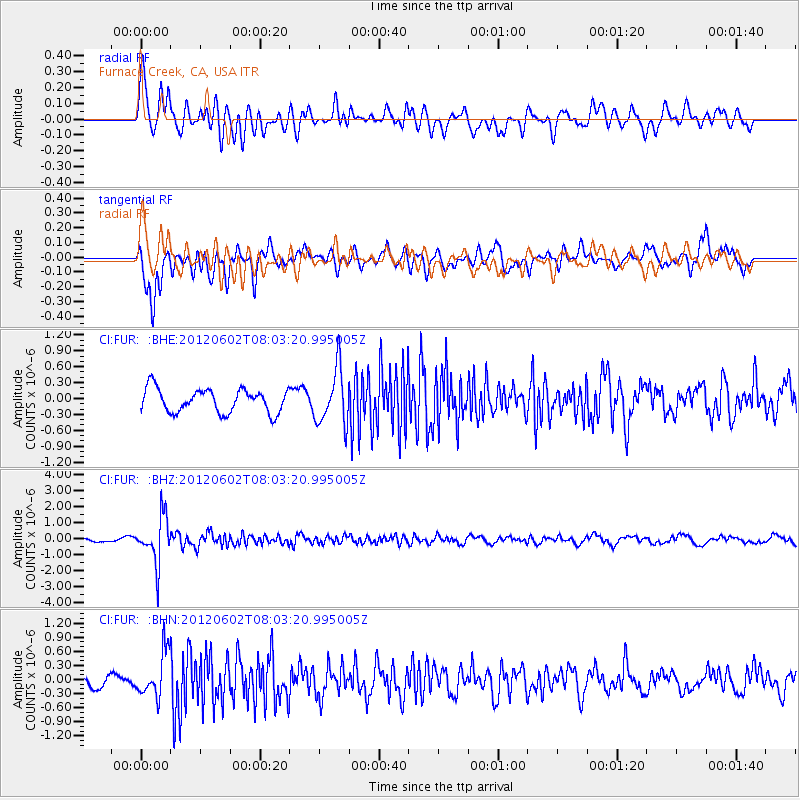
FUR Furnace Creek, CA, USA - Earthquake Result Viewer
*The percent match for this event was below the threshold and hence no stack was calculated.
| Earthquake location: |
Salta Province, Argentina |
| Earthquake latitude/longitude: |
-22.1/-63.6 |
| Earthquake time(UTC): |
2012/06/02 (154) 07:52:53 GMT |
| Earthquake Depth: |
527 km |
| Earthquake Magnitude: |
5.8 MB, 5.9 MW, 6.0 MW |
| Earthquake Catalog/Contributor: |
WHDF/NEIC |
|
| Network: |
CI Caltech Regional Seismic Network |
| Station: |
FUR Furnace Creek, CA, USA |
| Lat/Lon: |
36.47 N/116.86 W |
| Elevation: |
-37.0 m |
|
| Distance: |
76.9 deg |
| Az: |
318.431 deg |
| Baz: |
130.218 deg |
| Ray Param: |
$rayparam |
*The percent match for this event was below the threshold and hence was not used in the summary stack. |
|
| Radial Match: |
77.08828 % |
| Radial Bump: |
400 |
| Transverse Match: |
69.79457 % |
| Transverse Bump: |
400 |
| SOD ConfigId: |
455246 |
| Insert Time: |
2012-09-25 04:33:36.167 +0000 |
| GWidth: |
2.5 |
| Max Bumps: |
400 |
| Tol: |
0.001 |
|
Signal To Noise
| Channel | StoN | STA | LTA |
| CI:FUR: :BHZ:20120602T08:03:20.995005Z | 7.0932207 | 1.4394243E-6 | 2.0292958E-7 |
| CI:FUR: :BHN:20120602T08:03:20.995005Z | 2.9939413 | 4.7252695E-7 | 1.5782773E-7 |
| CI:FUR: :BHE:20120602T08:03:20.995005Z | 2.3560474 | 5.2250397E-7 | 2.217714E-7 |
| Arrivals |
| Ps | |
| PpPs | |
| PsPs/PpSs | |


