You are here: Home > Network List > TA - USArray Transportable Network (new EarthScope stations) Stations List
> Station Q41A Truxton, MO, USA > Earthquake Result Viewer
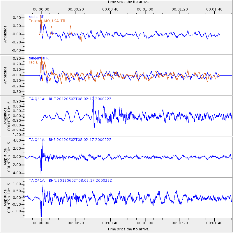
Q41A Truxton, MO, USA - Earthquake Result Viewer
*The percent match for this event was below the threshold and hence no stack was calculated.
| Earthquake location: |
Salta Province, Argentina |
| Earthquake latitude/longitude: |
-22.1/-63.6 |
| Earthquake time(UTC): |
2012/06/02 (154) 07:52:53 GMT |
| Earthquake Depth: |
527 km |
| Earthquake Magnitude: |
5.8 MB, 5.9 MW, 6.0 MW |
| Earthquake Catalog/Contributor: |
WHDF/NEIC |
|
| Network: |
TA USArray Transportable Network (new EarthScope stations) |
| Station: |
Q41A Truxton, MO, USA |
| Lat/Lon: |
38.95 N/91.23 W |
| Elevation: |
191 m |
|
| Distance: |
66.0 deg |
| Az: |
336.644 deg |
| Baz: |
151.857 deg |
| Ray Param: |
$rayparam |
*The percent match for this event was below the threshold and hence was not used in the summary stack. |
|
| Radial Match: |
68.14981 % |
| Radial Bump: |
400 |
| Transverse Match: |
73.92478 % |
| Transverse Bump: |
400 |
| SOD ConfigId: |
455246 |
| Insert Time: |
2012-09-25 05:08:51.158 +0000 |
| GWidth: |
2.5 |
| Max Bumps: |
400 |
| Tol: |
0.001 |
|
Signal To Noise
| Channel | StoN | STA | LTA |
| TA:Q41A: :BHZ:20120602T08:02:17.200022Z | 7.078748 | 1.4972281E-6 | 2.115103E-7 |
| TA:Q41A: :BHN:20120602T08:02:17.200022Z | 4.4968114 | 4.909806E-7 | 1.0918417E-7 |
| TA:Q41A: :BHE:20120602T08:02:17.200022Z | 2.273044 | 4.1886656E-7 | 1.842756E-7 |
| Arrivals |
| Ps | |
| PpPs | |
| PsPs/PpSs | |


