You are here: Home > Network List > TA - USArray Transportable Network (new EarthScope stations) Stations List
> Station T46A Princeton, KY, USA > Earthquake Result Viewer
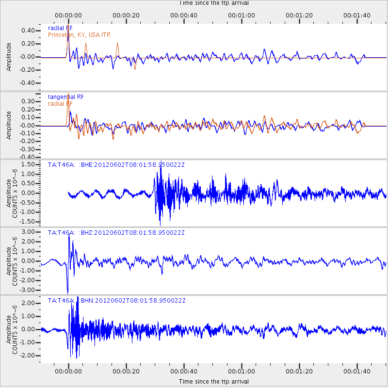
T46A Princeton, KY, USA - Earthquake Result Viewer
*The percent match for this event was below the threshold and hence no stack was calculated.
| Earthquake location: |
Salta Province, Argentina |
| Earthquake latitude/longitude: |
-22.1/-63.6 |
| Earthquake time(UTC): |
2012/06/02 (154) 07:52:53 GMT |
| Earthquake Depth: |
527 km |
| Earthquake Magnitude: |
5.8 MB, 5.9 MW, 6.0 MW |
| Earthquake Catalog/Contributor: |
WHDF/NEIC |
|
| Network: |
TA USArray Transportable Network (new EarthScope stations) |
| Station: |
T46A Princeton, KY, USA |
| Lat/Lon: |
37.04 N/87.89 W |
| Elevation: |
169 m |
|
| Distance: |
63.1 deg |
| Az: |
338.3 deg |
| Baz: |
154.616 deg |
| Ray Param: |
$rayparam |
*The percent match for this event was below the threshold and hence was not used in the summary stack. |
|
| Radial Match: |
69.26069 % |
| Radial Bump: |
400 |
| Transverse Match: |
81.099434 % |
| Transverse Bump: |
400 |
| SOD ConfigId: |
455246 |
| Insert Time: |
2012-09-25 05:15:29.939 +0000 |
| GWidth: |
2.5 |
| Max Bumps: |
400 |
| Tol: |
0.001 |
|
Signal To Noise
| Channel | StoN | STA | LTA |
| TA:T46A: :BHZ:20120602T08:01:58.950022Z | 5.506839 | 1.1950085E-6 | 2.1700446E-7 |
| TA:T46A: :BHN:20120602T08:01:58.950022Z | 10.304762 | 9.909849E-7 | 9.616766E-8 |
| TA:T46A: :BHE:20120602T08:01:58.950022Z | 5.0457277 | 6.0521074E-7 | 1.1994518E-7 |
| Arrivals |
| Ps | |
| PpPs | |
| PsPs/PpSs | |


