You are here: Home > Network List > TA - USArray Transportable Network (new EarthScope stations) Stations List
> Station X49A Woodville, AR, USA > Earthquake Result Viewer
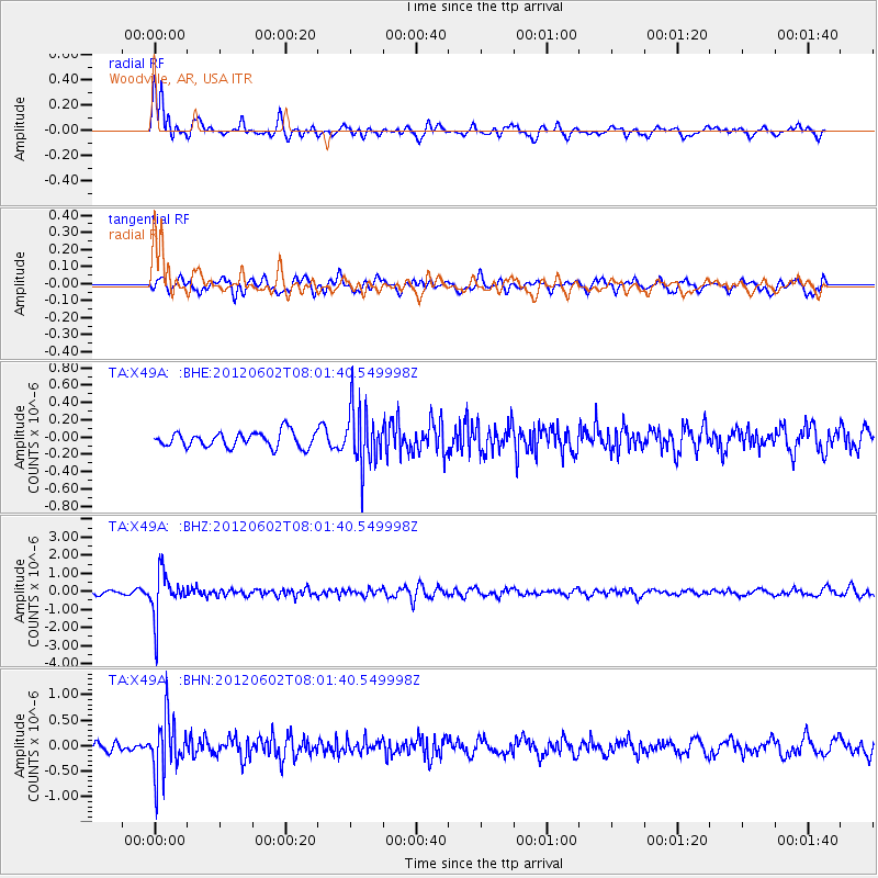
X49A Woodville, AR, USA - Earthquake Result Viewer
*The percent match for this event was below the threshold and hence no stack was calculated.
| Earthquake location: |
Salta Province, Argentina |
| Earthquake latitude/longitude: |
-22.1/-63.6 |
| Earthquake time(UTC): |
2012/06/02 (154) 07:52:53 GMT |
| Earthquake Depth: |
527 km |
| Earthquake Magnitude: |
5.8 MB, 5.9 MW, 6.0 MW |
| Earthquake Catalog/Contributor: |
WHDF/NEIC |
|
| Network: |
TA USArray Transportable Network (new EarthScope stations) |
| Station: |
X49A Woodville, AR, USA |
| Lat/Lon: |
34.51 N/86.33 W |
| Elevation: |
182 m |
|
| Distance: |
60.3 deg |
| Az: |
338.406 deg |
| Baz: |
155.579 deg |
| Ray Param: |
$rayparam |
*The percent match for this event was below the threshold and hence was not used in the summary stack. |
|
| Radial Match: |
64.31266 % |
| Radial Bump: |
400 |
| Transverse Match: |
65.98723 % |
| Transverse Bump: |
400 |
| SOD ConfigId: |
455246 |
| Insert Time: |
2012-09-25 05:16:47.217 +0000 |
| GWidth: |
2.5 |
| Max Bumps: |
400 |
| Tol: |
0.001 |
|
Signal To Noise
| Channel | StoN | STA | LTA |
| TA:X49A: :BHZ:20120602T08:01:40.549998Z | 10.911346 | 1.2361959E-6 | 1.1329454E-7 |
| TA:X49A: :BHN:20120602T08:01:40.549998Z | 8.769196 | 5.5048815E-7 | 6.277522E-8 |
| TA:X49A: :BHE:20120602T08:01:40.549998Z | 3.7626321 | 3.293346E-7 | 8.752772E-8 |
| Arrivals |
| Ps | |
| PpPs | |
| PsPs/PpSs | |


