You are here: Home > Network List > UW - Pacific Northwest Regional Seismic Network Stations List
> Station LEBA Lebam, WA, USA > Earthquake Result Viewer
LEBA Lebam, WA, USA - Earthquake Result Viewer
*The percent match for this event was below the threshold and hence no stack was calculated.
| Earthquake location: |
Salta Province, Argentina |
| Earthquake latitude/longitude: |
-22.1/-63.6 |
| Earthquake time(UTC): |
2012/06/02 (154) 07:52:53 GMT |
| Earthquake Depth: |
527 km |
| Earthquake Magnitude: |
5.8 MB, 5.9 MW, 6.0 MW |
| Earthquake Catalog/Contributor: |
WHDF/NEIC |
|
| Network: |
UW Pacific Northwest Regional Seismic Network |
| Station: |
LEBA Lebam, WA, USA |
| Lat/Lon: |
46.55 N/123.56 W |
| Elevation: |
73 m |
|
| Distance: |
87.1 deg |
| Az: |
323.235 deg |
| Baz: |
126.442 deg |
| Ray Param: |
$rayparam |
*The percent match for this event was below the threshold and hence was not used in the summary stack. |
|
| Radial Match: |
47.364693 % |
| Radial Bump: |
400 |
| Transverse Match: |
55.51612 % |
| Transverse Bump: |
400 |
| SOD ConfigId: |
455246 |
| Insert Time: |
2012-09-25 05:26:42.200 +0000 |
| GWidth: |
2.5 |
| Max Bumps: |
400 |
| Tol: |
0.001 |
|
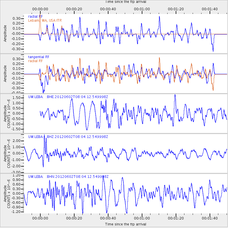
Signal To Noise
| Channel | StoN | STA | LTA |
| UW:LEBA: :BHZ:20120602T08:04:12.549998Z | 1.663369 | 1.1611012E-6 | 6.980418E-7 |
| UW:LEBA: :BHN:20120602T08:04:12.549998Z | 0.54200286 | 2.6578053E-7 | 4.9036737E-7 |
| UW:LEBA: :BHE:20120602T08:04:12.549998Z | 1.6098934 | 8.875465E-7 | 5.513076E-7 |
| Arrivals |
| Ps | |
| PpPs | |
| PsPs/PpSs | |


