You are here: Home > Network List > GS - US Geological Survey Networks Stations List
> Station KAN10 Keim Farm > Earthquake Result Viewer
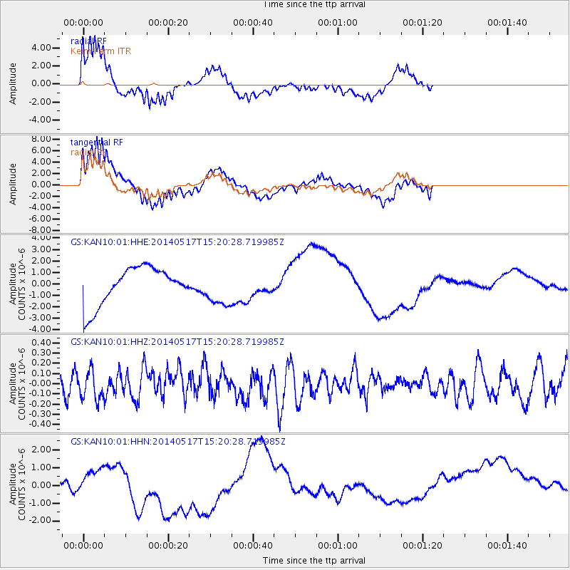
KAN10 Keim Farm - Earthquake Result Viewer
*The percent match for this event was below the threshold and hence no stack was calculated.
| Earthquake location: |
Tonga Islands |
| Earthquake latitude/longitude: |
-16.6/-175.2 |
| Earthquake time(UTC): |
2014/05/17 (137) 15:08:00 GMT |
| Earthquake Depth: |
10 km |
| Earthquake Magnitude: |
4.4 mb |
| Earthquake Catalog/Contributor: |
ISC/ISC |
|
| Network: |
GS US Geological Survey Networks |
| Station: |
KAN10 Keim Farm |
| Lat/Lon: |
37.12 N/98.10 W |
| Elevation: |
417 m |
|
| Distance: |
90.0 deg |
| Az: |
51.185 deg |
| Baz: |
249.147 deg |
| Ray Param: |
$rayparam |
*The percent match for this event was below the threshold and hence was not used in the summary stack. |
|
| Radial Match: |
66.80015 % |
| Radial Bump: |
400 |
| Transverse Match: |
80.96526 % |
| Transverse Bump: |
400 |
| SOD ConfigId: |
3390531 |
| Insert Time: |
2019-04-11 22:31:57.005 +0000 |
| GWidth: |
2.5 |
| Max Bumps: |
400 |
| Tol: |
0.001 |
|
Signal To Noise
| Channel | StoN | STA | LTA |
| GS:KAN10:01:HHZ:20140517T15:20:28.719985Z | 1.2533445 | 1.3944691E-7 | 1.1125983E-7 |
| GS:KAN10:01:HHN:20140517T15:20:28.719985Z | 0.38101482 | 6.178592E-7 | 1.6216145E-6 |
| GS:KAN10:01:HHE:20140517T15:20:28.719985Z | 0.9862342 | 1.6106675E-6 | 1.633149E-6 |
| Arrivals |
| Ps | |
| PpPs | |
| PsPs/PpSs | |


