You are here: Home > Network List > GS - US Geological Survey Networks Stations List
> Station KAN13 Rinehart Farm > Earthquake Result Viewer
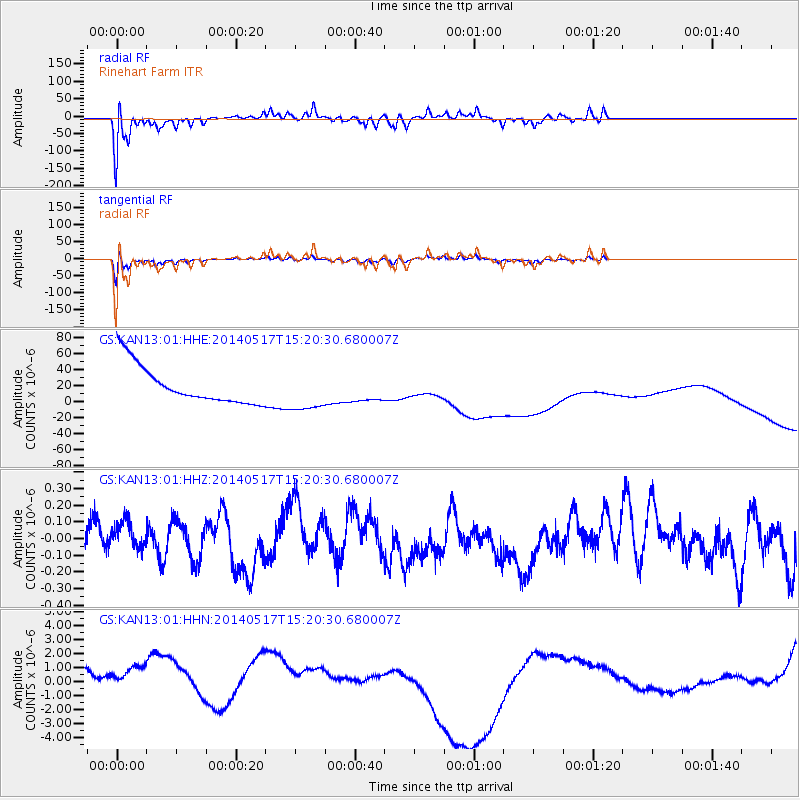
KAN13 Rinehart Farm - Earthquake Result Viewer
*The percent match for this event was below the threshold and hence no stack was calculated.
| Earthquake location: |
Tonga Islands |
| Earthquake latitude/longitude: |
-16.6/-175.2 |
| Earthquake time(UTC): |
2014/05/17 (137) 15:08:00 GMT |
| Earthquake Depth: |
10 km |
| Earthquake Magnitude: |
4.4 mb |
| Earthquake Catalog/Contributor: |
ISC/ISC |
|
| Network: |
GS US Geological Survey Networks |
| Station: |
KAN13 Rinehart Farm |
| Lat/Lon: |
37.01 N/97.48 W |
| Elevation: |
340 m |
|
| Distance: |
90.4 deg |
| Az: |
51.463 deg |
| Baz: |
249.516 deg |
| Ray Param: |
$rayparam |
*The percent match for this event was below the threshold and hence was not used in the summary stack. |
|
| Radial Match: |
67.52299 % |
| Radial Bump: |
353 |
| Transverse Match: |
67.931114 % |
| Transverse Bump: |
386 |
| SOD ConfigId: |
3390531 |
| Insert Time: |
2019-04-11 22:31:57.581 +0000 |
| GWidth: |
2.5 |
| Max Bumps: |
400 |
| Tol: |
0.001 |
|
Signal To Noise
| Channel | StoN | STA | LTA |
| GS:KAN13:01:HHZ:20140517T15:20:30.680007Z | 1.07375 | 1.14015826E-7 | 1.061847E-7 |
| GS:KAN13:01:HHN:20140517T15:20:30.680007Z | 1.1099802 | 2.0264551E-6 | 1.8256678E-6 |
| GS:KAN13:01:HHE:20140517T15:20:30.680007Z | 1.1014115 | 2.6277234E-5 | 2.3857781E-5 |
| Arrivals |
| Ps | |
| PpPs | |
| PsPs/PpSs | |


