You are here: Home > Network List > US - United States National Seismic Network Stations List
> Station MSO Missoula, Montana, USA > Earthquake Result Viewer
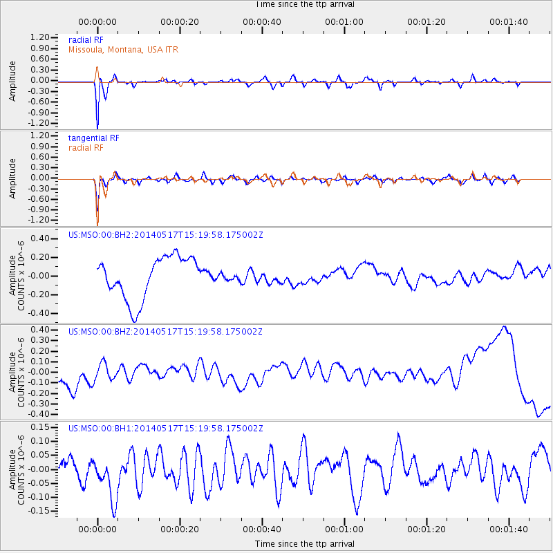
MSO Missoula, Montana, USA - Earthquake Result Viewer
*The percent match for this event was below the threshold and hence no stack was calculated.
| Earthquake location: |
Tonga Islands |
| Earthquake latitude/longitude: |
-16.6/-175.2 |
| Earthquake time(UTC): |
2014/05/17 (137) 15:08:00 GMT |
| Earthquake Depth: |
10 km |
| Earthquake Magnitude: |
4.4 mb |
| Earthquake Catalog/Contributor: |
ISC/ISC |
|
| Network: |
US United States National Seismic Network |
| Station: |
MSO Missoula, Montana, USA |
| Lat/Lon: |
46.83 N/113.94 W |
| Elevation: |
1264 m |
|
| Distance: |
83.7 deg |
| Az: |
37.284 deg |
| Baz: |
237.749 deg |
| Ray Param: |
$rayparam |
*The percent match for this event was below the threshold and hence was not used in the summary stack. |
|
| Radial Match: |
93.71743 % |
| Radial Bump: |
400 |
| Transverse Match: |
89.60018 % |
| Transverse Bump: |
400 |
| SOD ConfigId: |
3390531 |
| Insert Time: |
2019-04-11 22:34:33.186 +0000 |
| GWidth: |
2.5 |
| Max Bumps: |
400 |
| Tol: |
0.001 |
|
Signal To Noise
| Channel | StoN | STA | LTA |
| US:MSO:00:BHZ:20140517T15:19:58.175002Z | 0.47369105 | 7.835031E-8 | 1.6540383E-7 |
| US:MSO:00:BH1:20140517T15:19:58.175002Z | 2.0945833 | 9.931425E-8 | 4.74148E-8 |
| US:MSO:00:BH2:20140517T15:19:58.175002Z | 0.15398672 | 3.473E-8 | 2.2553893E-7 |
| Arrivals |
| Ps | |
| PpPs | |
| PsPs/PpSs | |


