You are here: Home > Network List > CI - Caltech Regional Seismic Network Stations List
> Station LGU LGU, Camarillo, CA, USA > Earthquake Result Viewer
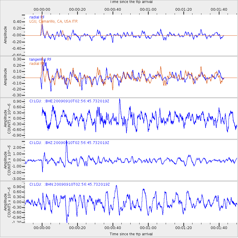
LGU LGU, Camarillo, CA, USA - Earthquake Result Viewer
*The percent match for this event was below the threshold and hence no stack was calculated.
| Earthquake location: |
Kuril Islands |
| Earthquake latitude/longitude: |
48.3/154.2 |
| Earthquake time(UTC): |
2009/09/10 (253) 02:46:50 GMT |
| Earthquake Depth: |
36 km |
| Earthquake Magnitude: |
6.0 MB, 5.5 MS, 6.0 MW, 5.8 MW |
| Earthquake Catalog/Contributor: |
WHDF/NEIC |
|
| Network: |
CI Caltech Regional Seismic Network |
| Station: |
LGU LGU, Camarillo, CA, USA |
| Lat/Lon: |
34.11 N/119.07 W |
| Elevation: |
416 m |
|
| Distance: |
63.4 deg |
| Az: |
67.835 deg |
| Baz: |
311.838 deg |
| Ray Param: |
$rayparam |
*The percent match for this event was below the threshold and hence was not used in the summary stack. |
|
| Radial Match: |
61.508873 % |
| Radial Bump: |
400 |
| Transverse Match: |
68.052574 % |
| Transverse Bump: |
400 |
| SOD ConfigId: |
2622 |
| Insert Time: |
2010-02-25 20:22:35.902 +0000 |
| GWidth: |
2.5 |
| Max Bumps: |
400 |
| Tol: |
0.001 |
|
Signal To Noise
| Channel | StoN | STA | LTA |
| CI:LGU: :BHZ:20090910T02:56:45.732019Z | 1.8791374 | 5.670837E-7 | 3.0177875E-7 |
| CI:LGU: :BHN:20090910T02:56:45.732019Z | 1.4662002 | 2.7817956E-7 | 1.8972823E-7 |
| CI:LGU: :BHE:20090910T02:56:45.732019Z | 1.0814463 | 3.116066E-7 | 2.8813878E-7 |
| Arrivals |
| Ps | |
| PpPs | |
| PsPs/PpSs | |


