You are here: Home > Network List > TA - USArray Transportable Network (new EarthScope stations) Stations List
> Station E37A Wrenshall, MN, USA > Earthquake Result Viewer
E37A Wrenshall, MN, USA - Earthquake Result Viewer

| Earthquake location: |
South Of Panama |
| Earthquake latitude/longitude: |
5.3/-82.6 |
| Earthquake time(UTC): |
2012/06/04 (156) 00:45:15 GMT |
| Earthquake Depth: |
7.0 km |
| Earthquake Magnitude: |
5.9 MB, 5.9 MS, 6.3 MW, 6.2 MW |
| Earthquake Catalog/Contributor: |
WHDF/NEIC |
|
| Network: |
TA USArray Transportable Network (new EarthScope stations) |
| Station: |
E37A Wrenshall, MN, USA |
| Lat/Lon: |
46.57 N/92.40 W |
| Elevation: |
304 m |
|
| Distance: |
42.0 deg |
| Az: |
349.915 deg |
| Baz: |
165.361 deg |
| Ray Param: |
0.07346489 |
| Estimated Moho Depth: |
41.75 km |
| Estimated Crust Vp/Vs: |
1.62 |
| Assumed Crust Vp: |
6.571 km/s |
| Estimated Crust Vs: |
4.069 km/s |
| Estimated Crust Poisson's Ratio: |
0.19 |
|
| Radial Match: |
86.81475 % |
| Radial Bump: |
400 |
| Transverse Match: |
51.522808 % |
| Transverse Bump: |
400 |
| SOD ConfigId: |
458385 |
| Insert Time: |
2012-10-16 08:23:44.156 +0000 |
| GWidth: |
2.5 |
| Max Bumps: |
400 |
| Tol: |
0.001 |
|
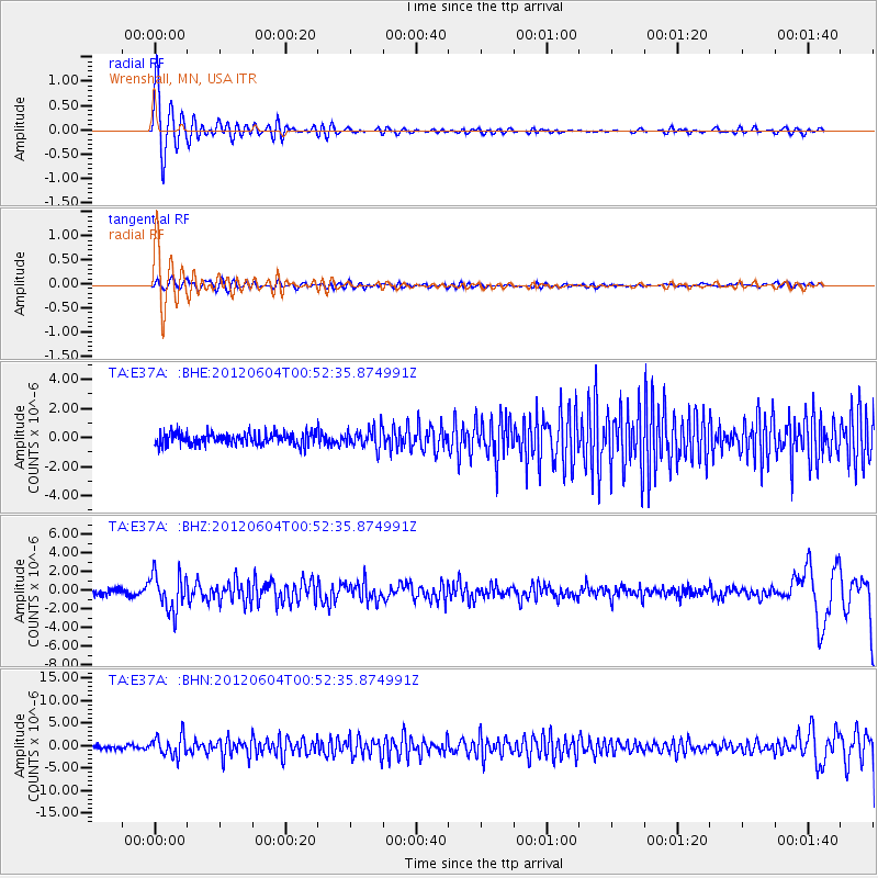
Signal To Noise
| Channel | StoN | STA | LTA |
| TA:E37A: :BHZ:20120604T00:52:35.874991Z | 6.2128353 | 1.9628112E-6 | 3.1592842E-7 |
| TA:E37A: :BHN:20120604T00:52:35.874991Z | 6.650723 | 2.256083E-6 | 3.3922373E-7 |
| TA:E37A: :BHE:20120604T00:52:35.874991Z | 1.5961862 | 6.777085E-7 | 4.2457984E-7 |
| Arrivals |
| Ps | 4.2 SECOND |
| PpPs | 15 SECOND |
| PsPs/PpSs | 20 SECOND |


