You are here: Home > Network List > G - GEOSCOPE Stations List
> Station SCZ Chualar Canyon, Santa Cruz, California, U.S.A. > Earthquake Result Viewer
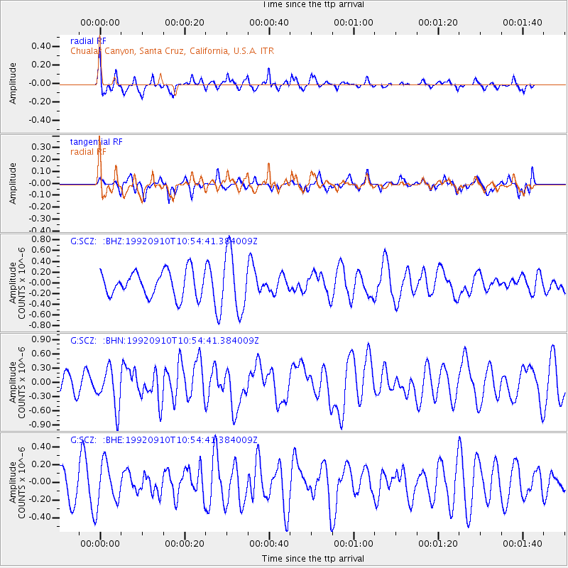
SCZ Chualar Canyon, Santa Cruz, California, U.S.A. - Earthquake Result Viewer
*The percent match for this event was below the threshold and hence no stack was calculated.
| Earthquake location: |
Tonga Islands Region |
| Earthquake latitude/longitude: |
-22.5/-175.1 |
| Earthquake time(UTC): |
1992/09/10 (254) 10:43:20 GMT |
| Earthquake Depth: |
39 km |
| Earthquake Magnitude: |
5.5 MB, 6.0 MS, 6.3 UNKNOWN |
| Earthquake Catalog/Contributor: |
WHDF/NEIC |
|
| Network: |
G GEOSCOPE |
| Station: |
SCZ Chualar Canyon, Santa Cruz, California, U.S.A. |
| Lat/Lon: |
36.60 N/121.40 W |
| Elevation: |
261 m |
|
| Distance: |
77.6 deg |
| Az: |
41.58 deg |
| Baz: |
229.691 deg |
| Ray Param: |
$rayparam |
*The percent match for this event was below the threshold and hence was not used in the summary stack. |
|
| Radial Match: |
50.315453 % |
| Radial Bump: |
374 |
| Transverse Match: |
48.747646 % |
| Transverse Bump: |
365 |
| SOD ConfigId: |
4480 |
| Insert Time: |
2010-02-26 23:56:44.337 +0000 |
| GWidth: |
2.5 |
| Max Bumps: |
400 |
| Tol: |
0.001 |
|
Signal To Noise
| Channel | StoN | STA | LTA |
| G:SCZ: :BHN:19920910T10:54:41.384009Z | 2.1239002 | 4.2597046E-7 | 2.0056049E-7 |
| G:SCZ: :BHE:19920910T10:54:41.384009Z | 1.3464899 | 2.2277902E-7 | 1.654517E-7 |
| G:SCZ: :BHZ:19920910T10:54:41.384009Z | 2.3679917 | 5.504466E-7 | 2.3245292E-7 |
| Arrivals |
| Ps | |
| PpPs | |
| PsPs/PpSs | |


