You are here: Home > Network List > G - GEOSCOPE Stations List
> Station SCZ Chualar Canyon, Santa Cruz, California, U.S.A. > Earthquake Result Viewer
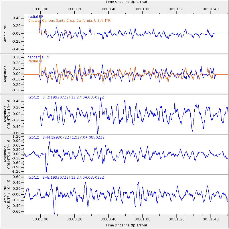
SCZ Chualar Canyon, Santa Cruz, California, U.S.A. - Earthquake Result Viewer
*The percent match for this event was below the threshold and hence no stack was calculated.
| Earthquake location: |
Mariana Islands Region |
| Earthquake latitude/longitude: |
21.8/144.2 |
| Earthquake time(UTC): |
1993/07/22 (203) 12:15:36 GMT |
| Earthquake Depth: |
126 km |
| Earthquake Magnitude: |
5.5 MB, 5.8 UNKNOWN |
| Earthquake Catalog/Contributor: |
WHDF/NEIC |
|
| Network: |
G GEOSCOPE |
| Station: |
SCZ Chualar Canyon, Santa Cruz, California, U.S.A. |
| Lat/Lon: |
36.60 N/121.40 W |
| Elevation: |
261 m |
|
| Distance: |
80.7 deg |
| Az: |
54.398 deg |
| Baz: |
290.089 deg |
| Ray Param: |
$rayparam |
*The percent match for this event was below the threshold and hence was not used in the summary stack. |
|
| Radial Match: |
49.456318 % |
| Radial Bump: |
326 |
| Transverse Match: |
53.98181 % |
| Transverse Bump: |
400 |
| SOD ConfigId: |
4480 |
| Insert Time: |
2010-02-26 23:57:40.980 +0000 |
| GWidth: |
2.5 |
| Max Bumps: |
400 |
| Tol: |
0.001 |
|
Signal To Noise
| Channel | StoN | STA | LTA |
| G:SCZ: :BHN:19930722T12:27:04.085022Z | 2.9179842 | 4.3592476E-7 | 1.4939243E-7 |
| G:SCZ: :BHE:19930722T12:27:04.085022Z | 0.7835874 | 9.600096E-8 | 1.2251468E-7 |
| G:SCZ: :BHZ:19930722T12:27:04.085022Z | 1.5174611 | 2.4720865E-7 | 1.6290937E-7 |
| Arrivals |
| Ps | |
| PpPs | |
| PsPs/PpSs | |


