You are here: Home > Network List > TA - USArray Transportable Network (new EarthScope stations) Stations List
> Station A31A Linda, St. Vincent, MN, USA > Earthquake Result Viewer
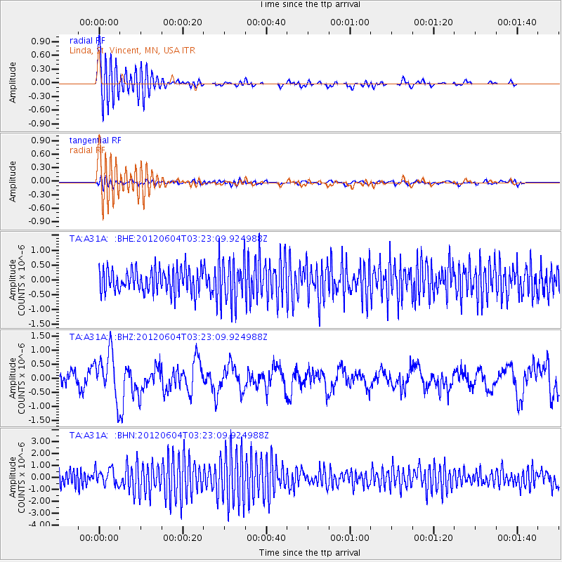
A31A Linda, St. Vincent, MN, USA - Earthquake Result Viewer
*The percent match for this event was below the threshold and hence no stack was calculated.
| Earthquake location: |
South Of Panama |
| Earthquake latitude/longitude: |
5.5/-82.6 |
| Earthquake time(UTC): |
2012/06/04 (156) 03:15:24 GMT |
| Earthquake Depth: |
7.0 km |
| Earthquake Magnitude: |
5.8 MB, 5.8 MS, 6.3 MW, 6.1 MW |
| Earthquake Catalog/Contributor: |
WHDF/NEIC |
|
| Network: |
TA USArray Transportable Network (new EarthScope stations) |
| Station: |
A31A Linda, St. Vincent, MN, USA |
| Lat/Lon: |
48.93 N/97.19 W |
| Elevation: |
244 m |
|
| Distance: |
45.0 deg |
| Az: |
346.384 deg |
| Baz: |
159.185 deg |
| Ray Param: |
$rayparam |
*The percent match for this event was below the threshold and hence was not used in the summary stack. |
|
| Radial Match: |
71.82725 % |
| Radial Bump: |
400 |
| Transverse Match: |
39.147194 % |
| Transverse Bump: |
400 |
| SOD ConfigId: |
458385 |
| Insert Time: |
2012-10-16 09:00:18.052 +0000 |
| GWidth: |
2.5 |
| Max Bumps: |
400 |
| Tol: |
0.001 |
|
Signal To Noise
| Channel | StoN | STA | LTA |
| TA:A31A: :BHZ:20120604T03:23:09.924988Z | 3.234013 | 8.415126E-7 | 2.6020692E-7 |
| TA:A31A: :BHN:20120604T03:23:09.924988Z | 1.2629238 | 6.79399E-7 | 5.3795725E-7 |
| TA:A31A: :BHE:20120604T03:23:09.924988Z | 1.8603228 | 7.1476956E-7 | 3.8421803E-7 |
| Arrivals |
| Ps | |
| PpPs | |
| PsPs/PpSs | |


