You are here: Home > Network List > TA - USArray Transportable Network (new EarthScope stations) Stations List
> Station K36A Gilmore City, IA, USA > Earthquake Result Viewer
K36A Gilmore City, IA, USA - Earthquake Result Viewer

| Earthquake location: |
South Of Panama |
| Earthquake latitude/longitude: |
5.5/-82.6 |
| Earthquake time(UTC): |
2012/06/04 (156) 03:15:24 GMT |
| Earthquake Depth: |
7.0 km |
| Earthquake Magnitude: |
5.8 MB, 5.8 MS, 6.3 MW, 6.1 MW |
| Earthquake Catalog/Contributor: |
WHDF/NEIC |
|
| Network: |
TA USArray Transportable Network (new EarthScope stations) |
| Station: |
K36A Gilmore City, IA, USA |
| Lat/Lon: |
42.64 N/94.45 W |
| Elevation: |
364 m |
|
| Distance: |
38.5 deg |
| Az: |
345.851 deg |
| Baz: |
160.746 deg |
| Ray Param: |
0.07556219 |
| Estimated Moho Depth: |
38.75 km |
| Estimated Crust Vp/Vs: |
1.92 |
| Assumed Crust Vp: |
6.53 km/s |
| Estimated Crust Vs: |
3.397 km/s |
| Estimated Crust Poisson's Ratio: |
0.31 |
|
| Radial Match: |
86.73686 % |
| Radial Bump: |
400 |
| Transverse Match: |
64.40121 % |
| Transverse Bump: |
400 |
| SOD ConfigId: |
458385 |
| Insert Time: |
2012-10-16 09:03:08.092 +0000 |
| GWidth: |
2.5 |
| Max Bumps: |
400 |
| Tol: |
0.001 |
|
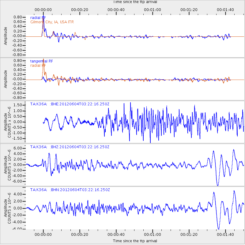
Signal To Noise
| Channel | StoN | STA | LTA |
| TA:K36A: :BHZ:20120604T03:22:16.250Z | 10.14437 | 2.1895119E-6 | 2.1583517E-7 |
| TA:K36A: :BHN:20120604T03:22:16.250Z | 3.9116497 | 8.711827E-7 | 2.227149E-7 |
| TA:K36A: :BHE:20120604T03:22:16.250Z | 1.3902497 | 4.4953805E-7 | 3.2335058E-7 |
| Arrivals |
| Ps | 5.9 SECOND |
| PpPs | 16 SECOND |
| PsPs/PpSs | 22 SECOND |


