You are here: Home > Network List > TA - USArray Transportable Network (new EarthScope stations) Stations List
> Station H17A Grant Village (NPS), Yellowstone Nt. Park, WY, USA > Earthquake Result Viewer
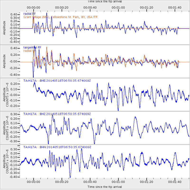
H17A Grant Village (NPS), Yellowstone Nt. Park, WY, USA - Earthquake Result Viewer
*The percent match for this event was below the threshold and hence no stack was calculated.
| Earthquake location: |
Samoa Islands Region |
| Earthquake latitude/longitude: |
-14.9/-175.6 |
| Earthquake time(UTC): |
2014/05/18 (138) 06:38:41 GMT |
| Earthquake Depth: |
26 km |
| Earthquake Magnitude: |
5.6 MW |
| Earthquake Catalog/Contributor: |
ISC/ISC |
|
| Network: |
TA USArray Transportable Network (new EarthScope stations) |
| Station: |
H17A Grant Village (NPS), Yellowstone Nt. Park, WY, USA |
| Lat/Lon: |
44.40 N/110.58 W |
| Elevation: |
2400 m |
|
| Distance: |
83.5 deg |
| Az: |
40.865 deg |
| Baz: |
241.912 deg |
| Ray Param: |
$rayparam |
*The percent match for this event was below the threshold and hence was not used in the summary stack. |
|
| Radial Match: |
53.02194 % |
| Radial Bump: |
400 |
| Transverse Match: |
62.507286 % |
| Transverse Bump: |
400 |
| SOD ConfigId: |
3390531 |
| Insert Time: |
2019-04-11 22:58:36.194 +0000 |
| GWidth: |
2.5 |
| Max Bumps: |
400 |
| Tol: |
0.001 |
|
Signal To Noise
| Channel | StoN | STA | LTA |
| TA:H17A: :BHZ:20140518T06:50:35.674009Z | 0.5927646 | 3.371149E-8 | 5.6871627E-8 |
| TA:H17A: :BHN:20140518T06:50:35.674009Z | 0.9495399 | 5.2380095E-8 | 5.516366E-8 |
| TA:H17A: :BHE:20140518T06:50:35.674009Z | 1.3829597 | 9.613496E-8 | 6.951392E-8 |
| Arrivals |
| Ps | |
| PpPs | |
| PsPs/PpSs | |


