You are here: Home > Network List > TA - USArray Transportable Network (new EarthScope stations) Stations List
> Station O03E Paynes Creek, CA, USA > Earthquake Result Viewer
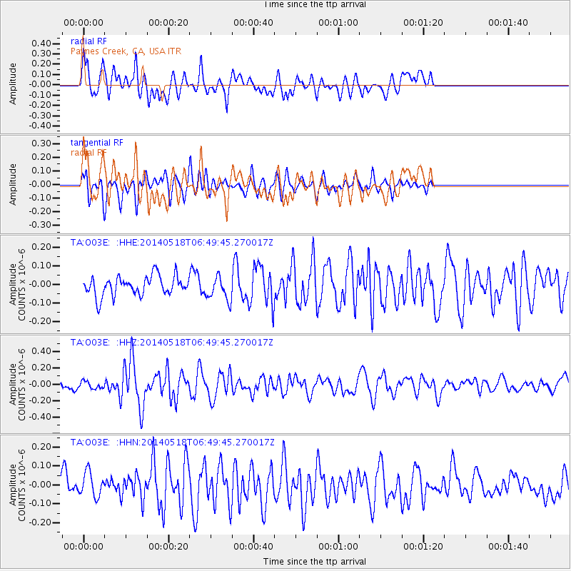
O03E Paynes Creek, CA, USA - Earthquake Result Viewer
*The percent match for this event was below the threshold and hence no stack was calculated.
| Earthquake location: |
Samoa Islands Region |
| Earthquake latitude/longitude: |
-14.9/-175.6 |
| Earthquake time(UTC): |
2014/05/18 (138) 06:38:41 GMT |
| Earthquake Depth: |
26 km |
| Earthquake Magnitude: |
5.6 MW |
| Earthquake Catalog/Contributor: |
ISC/ISC |
|
| Network: |
TA USArray Transportable Network (new EarthScope stations) |
| Station: |
O03E Paynes Creek, CA, USA |
| Lat/Lon: |
40.29 N/121.80 W |
| Elevation: |
967 m |
|
| Distance: |
74.3 deg |
| Az: |
39.909 deg |
| Baz: |
234.175 deg |
| Ray Param: |
$rayparam |
*The percent match for this event was below the threshold and hence was not used in the summary stack. |
|
| Radial Match: |
62.3814 % |
| Radial Bump: |
400 |
| Transverse Match: |
54.144913 % |
| Transverse Bump: |
348 |
| SOD ConfigId: |
3390531 |
| Insert Time: |
2019-04-11 22:58:41.858 +0000 |
| GWidth: |
2.5 |
| Max Bumps: |
400 |
| Tol: |
0.001 |
|
Signal To Noise
| Channel | StoN | STA | LTA |
| TA:O03E: :HHZ:20140518T06:49:45.270017Z | 1.1954415 | 4.397721E-8 | 3.6787423E-8 |
| TA:O03E: :HHN:20140518T06:49:45.270017Z | 1.1666808 | 7.165243E-8 | 6.141562E-8 |
| TA:O03E: :HHE:20140518T06:49:45.270017Z | 1.2471049 | 6.46688E-8 | 5.1855142E-8 |
| Arrivals |
| Ps | |
| PpPs | |
| PsPs/PpSs | |


