MPM Manuel Prospect Mine, California, USA - Earthquake Result Viewer
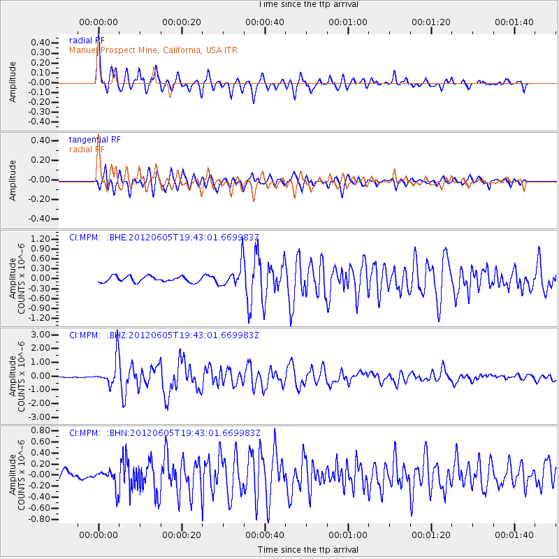
Earthquake location: Off East Coast Of Honshu, Japan
Earthquake latitude/longitude: 34.9/141.1
Earthquake time(UTC): 2012/06/05 (157) 19:31:33 GMT
Earthquake Depth: 15 km
Earthquake Magnitude: 6.2 MB, 6.0 MS, 6.1 MW, 6.1 MW
Earthquake Catalog/Contributor: WHDF/NEIC
Network: CI Caltech Regional Seismic Network
Station: MPM Manuel Prospect Mine, California, USA
Lat/Lon: 36.06 N/117.49 W
Elevation: 185 m
Distance: 78.3 deg
Az: 54.216 deg
Baz: 304.668 deg
Ray Param: 0.04972667
Estimated Moho Depth: 32.0 km
Estimated Crust Vp/Vs: 1.79
Assumed Crust Vp: 6.279 km/s
Estimated Crust Vs: 3.517 km/s
Estimated Crust Poisson's Ratio: 0.27
Radial Match: 90.99632 %
Radial Bump: 400
Transverse Match: 88.580086 %
Transverse Bump: 400
SOD ConfigId: 458385
Insert Time: 2012-10-16 09:51:57.911 +0000
GWidth: 2.5
Max Bumps: 400
Tol: 0.001

Signal To Noise

ChannelStoNSTALTA
CI:MPM: :BHZ:20120605T19:43:01.669983Z19.2738321.0374079E-65.3824678E-8
CI:MPM: :BHN:20120605T19:43:01.669983Z1.51018621.7623695E-71.16698814E-7
CI:MPM: :BHE:20120605T19:43:01.669983Z4.30012233.6882824E-78.5771575E-8
Arrivals
Ps4.1 SECOND
PpPs14 SECOND
PsPs/PpSs18 SECOND