You are here: Home > Network List > GS - US Geological Survey Networks Stations List
> Station KAN13 Rinehart Farm > Earthquake Result Viewer
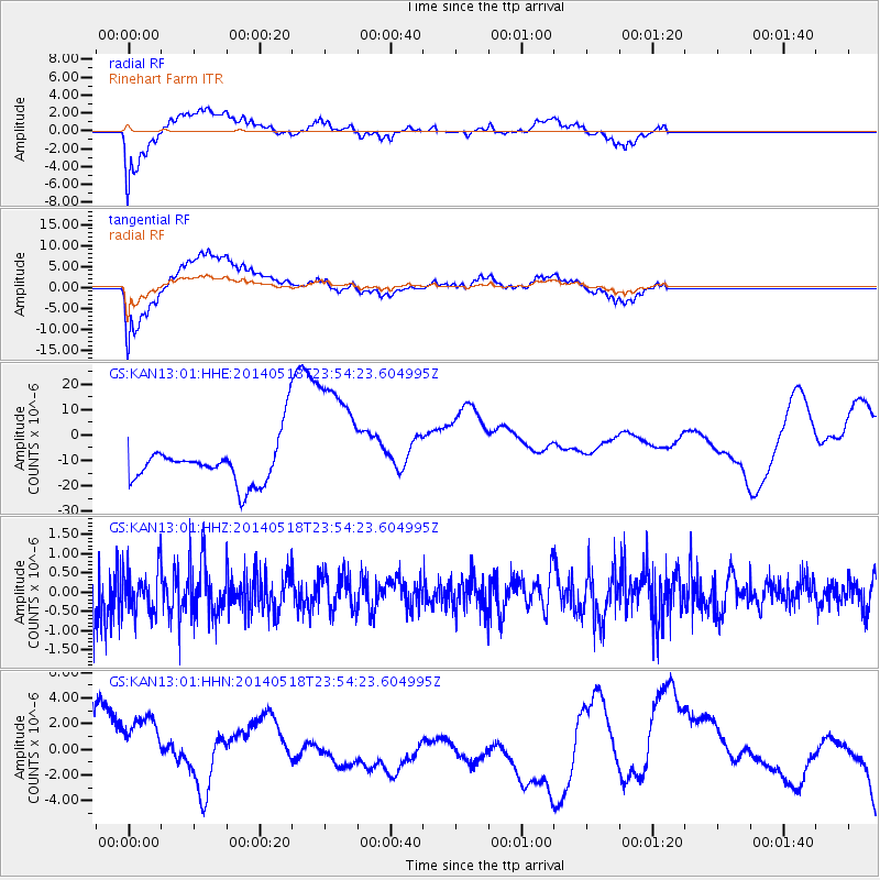
KAN13 Rinehart Farm - Earthquake Result Viewer
*The percent match for this event was below the threshold and hence no stack was calculated.
| Earthquake location: |
Central East Pacific Rise |
| Earthquake latitude/longitude: |
-4.5/-106.0 |
| Earthquake time(UTC): |
2014/05/18 (138) 23:47:04 GMT |
| Earthquake Depth: |
17 km |
| Earthquake Magnitude: |
5.9 MW |
| Earthquake Catalog/Contributor: |
ISC/ISC |
|
| Network: |
GS US Geological Survey Networks |
| Station: |
KAN13 Rinehart Farm |
| Lat/Lon: |
37.01 N/97.48 W |
| Elevation: |
340 m |
|
| Distance: |
42.0 deg |
| Az: |
10.233 deg |
| Baz: |
192.784 deg |
| Ray Param: |
$rayparam |
*The percent match for this event was below the threshold and hence was not used in the summary stack. |
|
| Radial Match: |
50.213173 % |
| Radial Bump: |
400 |
| Transverse Match: |
51.332237 % |
| Transverse Bump: |
400 |
| SOD ConfigId: |
3390531 |
| Insert Time: |
2019-04-11 23:06:37.025 +0000 |
| GWidth: |
2.5 |
| Max Bumps: |
400 |
| Tol: |
0.001 |
|
Signal To Noise
| Channel | StoN | STA | LTA |
| GS:KAN13:01:HHZ:20140518T23:54:23.604995Z | 0.71153885 | 5.523375E-7 | 7.7625765E-7 |
| GS:KAN13:01:HHN:20140518T23:54:23.604995Z | 1.8537233 | 3.2953033E-6 | 1.7776673E-6 |
| GS:KAN13:01:HHE:20140518T23:54:23.604995Z | 3.1683054 | 2.6167945E-5 | 8.259288E-6 |
| Arrivals |
| Ps | |
| PpPs | |
| PsPs/PpSs | |


