N23A Red Feather Lakes, CO, USA - Earthquake Result Viewer
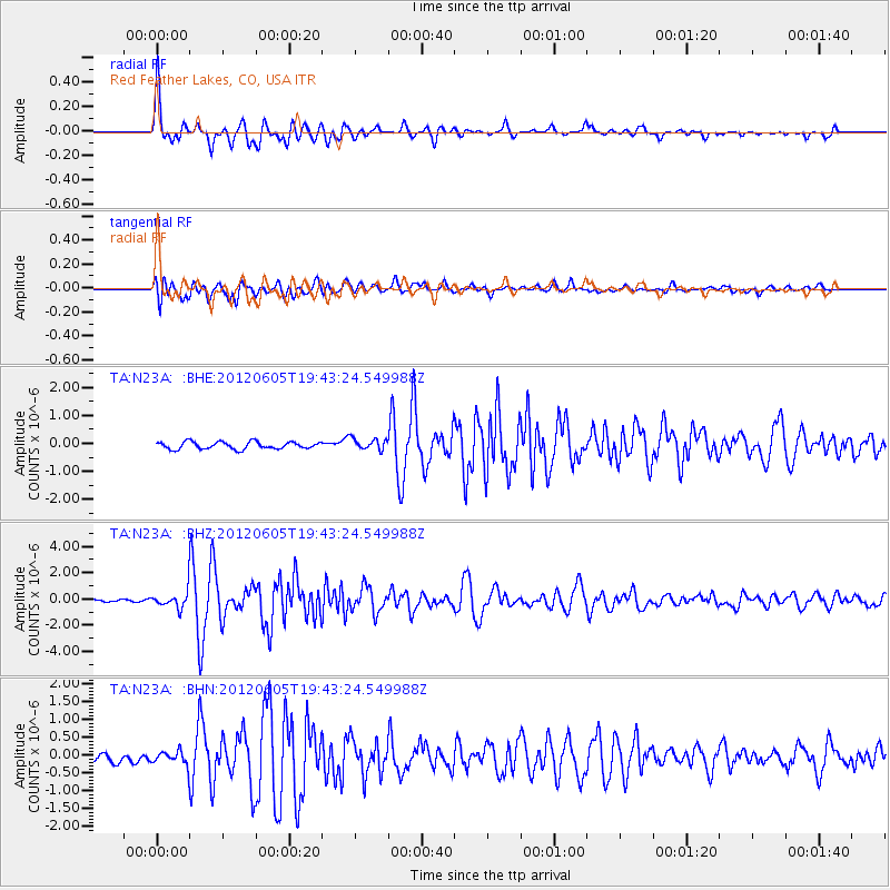
Earthquake location: Off East Coast Of Honshu, Japan
Earthquake latitude/longitude: 34.9/141.1
Earthquake time(UTC): 2012/06/05 (157) 19:31:33 GMT
Earthquake Depth: 15 km
Earthquake Magnitude: 6.2 MB, 6.0 MS, 6.1 MW, 6.1 MW
Earthquake Catalog/Contributor: WHDF/NEIC
Network: TA USArray Transportable Network (new EarthScope stations)
Station: N23A Red Feather Lakes, CO, USA
Lat/Lon: 40.89 N/105.94 W
Elevation: 2458 m
Distance: 82.6 deg
Az: 44.759 deg
Baz: 310.267 deg
Ray Param: 0.046784796
Estimated Moho Depth: 47.75 km
Estimated Crust Vp/Vs: 1.81
Assumed Crust Vp: 6.306 km/s
Estimated Crust Vs: 3.489 km/s
Estimated Crust Poisson's Ratio: 0.28
Radial Match: 94.26416 %
Radial Bump: 400
Transverse Match: 82.16468 %
Transverse Bump: 400
SOD ConfigId: 458385
Insert Time: 2012-10-16 10:12:16.399 +0000
GWidth: 2.5
Max Bumps: 400
Tol: 0.001

Signal To Noise

ChannelStoNSTALTA
TA:N23A: :BHZ:20120605T19:43:24.549988Z4.2814396.2715884E-71.464832E-7
TA:N23A: :BHN:20120605T19:43:24.549988Z1.17426051.874708E-71.596501E-7
TA:N23A: :BHE:20120605T19:43:24.549988Z1.63452172.1037354E-71.2870647E-7
Arrivals
Ps6.3 SECOND
PpPs21 SECOND
PsPs/PpSs27 SECOND